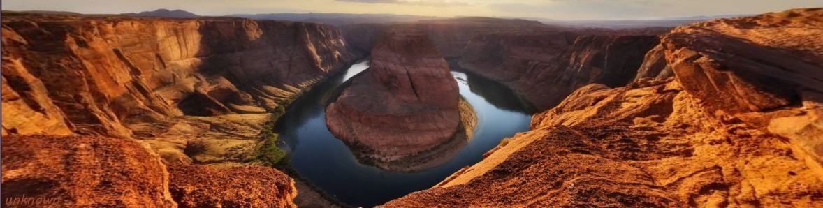
Horseshoe Bend of Colorado River near Page, Arizona
Horseshoe Bend is the name for a horseshoe-shaped meander of the Colorado River located near Page, Arizona.
It is located five miles (8.5 km) downstream from the Glen Canyon Dam and Lake Powell within Glen Canyon National Recreation Area, about four miles (six km) southwest of Page.
Horseshoe Bend can be viewed from the steep cliff above.
The overlook is 4,200 [1,300 m] feet above sea level and the Colorado River is at 3,200 feet [980 m] above sea level making it a breathtaking 1,000 foot drop [300 m].
It is a short ¾ of a mile hike from US Route 89.
(Quote: Visit Arizona, [bracketed metric dimensions] added )
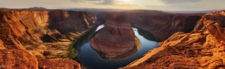
There are hundreds of photos of the Bend - most are taken from the trail overlook near the center of the Bend. They are all similar other than some are at various times of the day, others and in different seasons. Many are panoramic views like the banner photo that provide a more-or-less distorted view of the Bend, spreading the area around the Colorado and turning the steep cliffs into slopes.
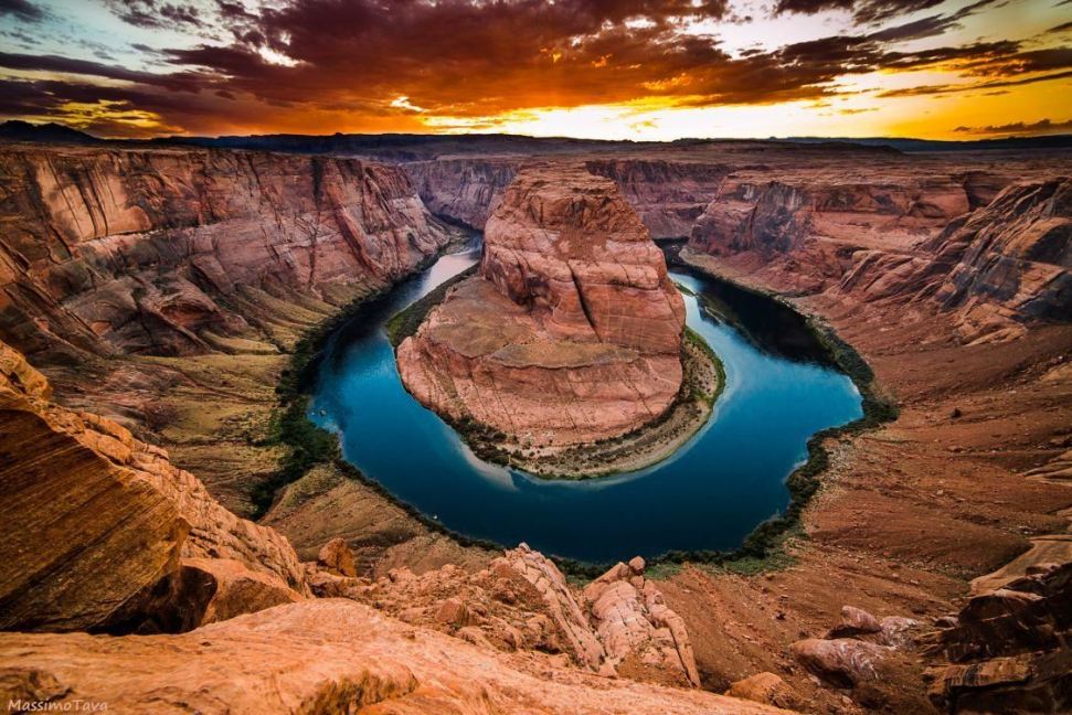
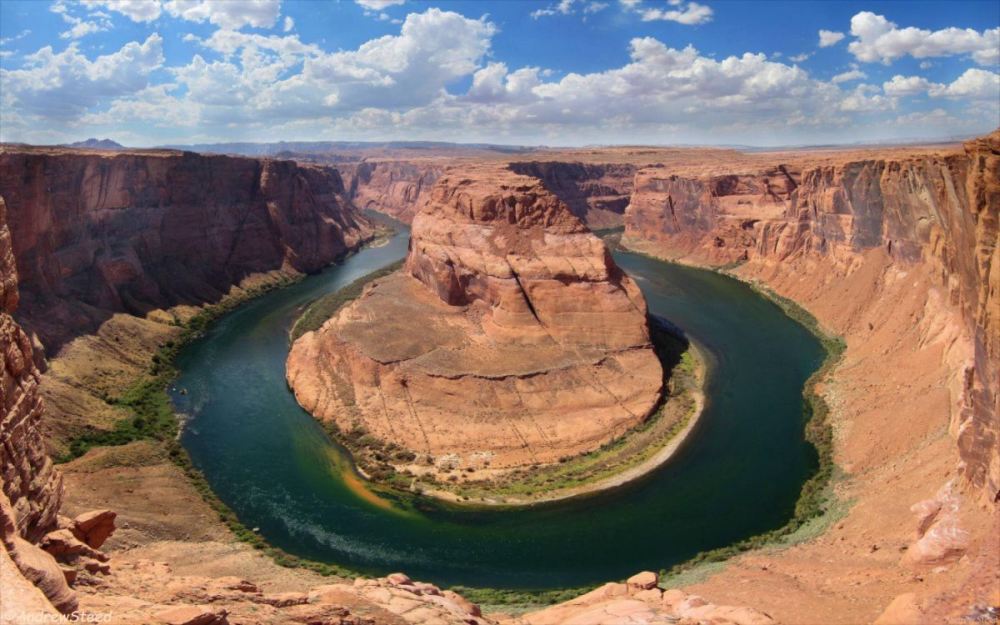
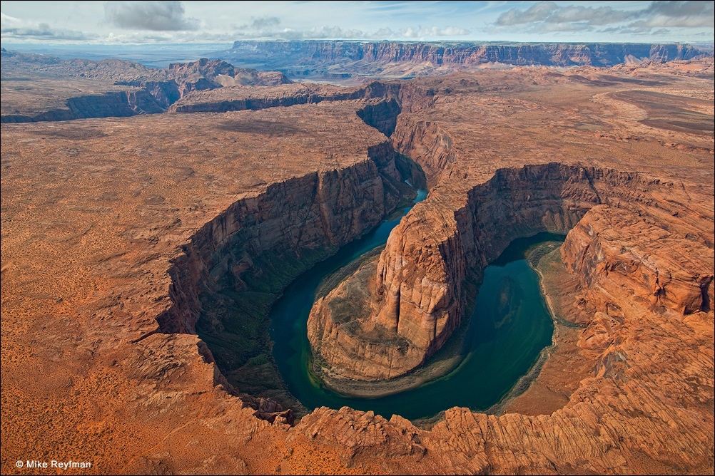
We have chosen four photos: a brilliant sunset photo that, like the banner and its original panorama, significantly distorts the geolory, a mid-day photo that accurately displays the geolory, an aerial photo that displays the Colorado as it cuts deeply into the unbroken Colorado Pleateau with Marble Canyon and the Vermillion Cliffs in the distant background, and the panorama from which the banner was cut. The map has been cut from NPS' Glen Canyon National Recreation Area map with a lot of interesting stuff on it.
Significant increases in the number of visitors has caused congestion in the area sometimes causing temporary closing access to the site.
The NPS recently constructed safety rails and a viewing platform (2018). The city of Page is charging a $10 per car parking fee (2019).
Select a tile to view its photo.