Mesa Verde National Park
Mesa Verde National Park is a U.S. National Park and UNESCO World Heritage Site located in Montezuma County, Colorado.
It is the largest archaeological preserve in the United States.
The park was created in 1906 by President Theodore Roosevelt to protect some of the best-preserved cliff dwellings in the world, or as he said, preserve the works of man.
[Wikipedia] Mesa Verde is off US160 in southwestern Colorado, 48 miles (77 km) northeast of the Four Corners Monument, 10 miles east of Cortez and 35 miles (56 km) west of historic Durango, Colorado.
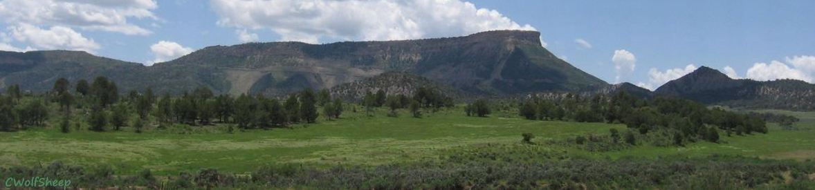
Mesa Verde, Spanish for green table, offers a spectacular look into the lives of the Ancestral Puebloan people who made it their home for over 700 years, from A.D. 600 to 1300. By the year 750 the people were building mesa-top villages made of adobe. In the late 1190s they began to build the cliff dwellings for which Mesa Verde is famous. It is possible that they left the area, as happened about the same time in many other area archaeologic sites, because of what is believed to have been a 23-year drought.
Today the park protects nearly 5,000 known archeological sites, including 600 cliff dwellings. These sites are some of the most notable and best preserved in the US. The cliff dwellings were built to take advantage of solar energy. The angle of the sun in winter warmed the masonry of the cliff dwellings, warm breezes blew from the valley, and the air was ten to twenty degrees warmer in the canyon alcoves than on the top of the mesa. In the summer, with the sun high overhead, much of the cliff dwellings were protected from direct sunlight.
Nearby archaeological sites along the Trail of the Ancients include Canyons of the Ancients, Canyon de Chelly, Chaco Culture, and Aztec Ruins National Parks and Monuments - the area has many documented and undocumented archaeological sites.
The Photo Gallery has twenty three photos in Mesa Verde (a very small sample of the 600 cliff dwellings) with an auto-show of the photos.
Mesa Verde Map shows the road system inside the park and highlights many of the ruins.
Mesa Verde Area is a Google satellite map of the surrounding area in Colorado, Utah, Arizona, and New Mexico - the four corners area.
The map shows the renamed US491 - previously US666, by which it is still identified on some maps. It was the 5th spur off US66 so it should have been US561, was renamed because of the objection to 666 claiming the the mark of the beast was causing many fatal accidents on the highway. I have driven that highway over the years, and I can attest that it is driver error that causes the accidents. So they renamed it US491, which indicates it is the 4th spur off US91, nearly 300 miles away on the western side of Utah (mostly replaced by I-15). Really...
Spruce Tree House is closed due to rock instability - read the  NPS article for more info.