Mule Canyon in Southeastern Utah
Mule Canyon, inside archaeologically-rich Cedar Mesa, runs roughly parallel to Scenic Byway 95 (SB95) in southeastern Utah. The canyon is figuratively divided as SB95 crosses it, with Mule Canyon North Fork and Mule Canyon South Fork to the north of the highway, and much deeper Lower Mule Canyon to the south of SB95, the canyon ending as it enters Comb Wash. Comb Wash runs alongside the western edge of Comb Ridge, whereas Butler Wash and its ruins are alongside the eastern edge. In addition to the rich cultural history of the canyon are the beautiful scenic landscapes and rugged geology in this lightly travelled section of southeastern Utah.
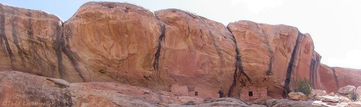
The two most visited sites, 20 miles southwest of Blanding on SB95, are the restored Roadside Ruins near a parking area on the north side of the highway between mile markers 101 & 102, and the oft-photographed House on Fire
ruin 1.5 miles up South Fork from the trailhead, about .5 mile north on Arch Canyon Road at SB95 mile marker 102.
The trail into North Fork is a short distance farther up the road.
The Lower Canyon trail enters from Comb Wash, and the rough Towers trail south off SB95 near mile marker 102 follows the lower canyon rim for a short distance with no access down the steep cliffs into the canyon.
Mule Canyon ruins have above-ground and below-ground dwellings. It appears to have been occupied about 750 AD, and reached its peak between 1,000 and 1,150 AD. Pottery and architecture from this location indicate a strong influence from the Mesa Verde ancestral Puebloans of Colorado, in addition to a less significant influence of the Kayenta ancestral Puebloans of northwest Arizona.
The Ancestral Puebloans (sometimes referred to as the Anasazi) were dry farmers. Botanical and archeological studies indicate that corn, beans and squash provided the staple foods of these peoples and were supplemented by a variety of wild plants and animals.
The Photo Gallery contains scenic photos and ruins - two Roadside ruin photos, nine in the lower canyon, and nine photos in the upper canyons with an auto-show of the photos.
The Mule Canyon Map was cut from the Cedar Mesa map and enlarged to better show the canyon and its forks.
The Cedar Mesa Map shows many (but certainly not all) of the canyons and archaeological sites inside Cedar Mesa.