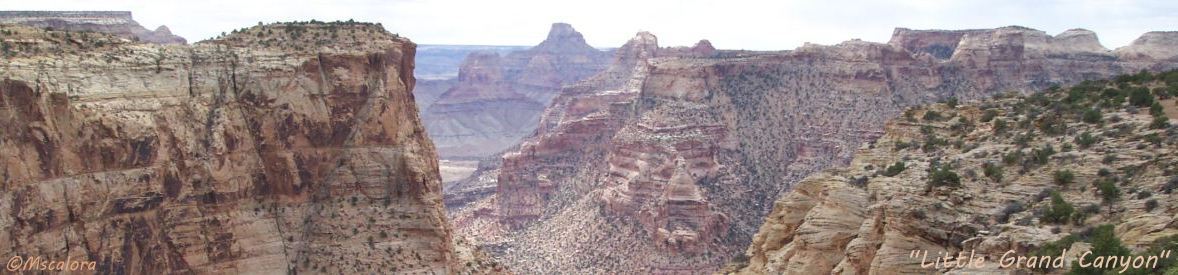
San Rafael Swell - the best kept secret in the west!
Or, at least, it used to be. Now that I-70 cuts through the Swell, the secret is out. The San Rafael Swell is a large geologic feature located in south-central Utah, west of Green River, Utah. Approximately 40 miles by 75 miles (64 km by 121 km), the Swell is a giant dome-shaped anticline of sandstone, shale, and limestone that was pushed up during the Laramide Orogeny 60-40 million years ago, about the same time the Rocky Mountains and area monoclines were created.
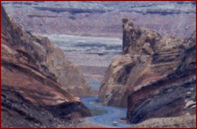
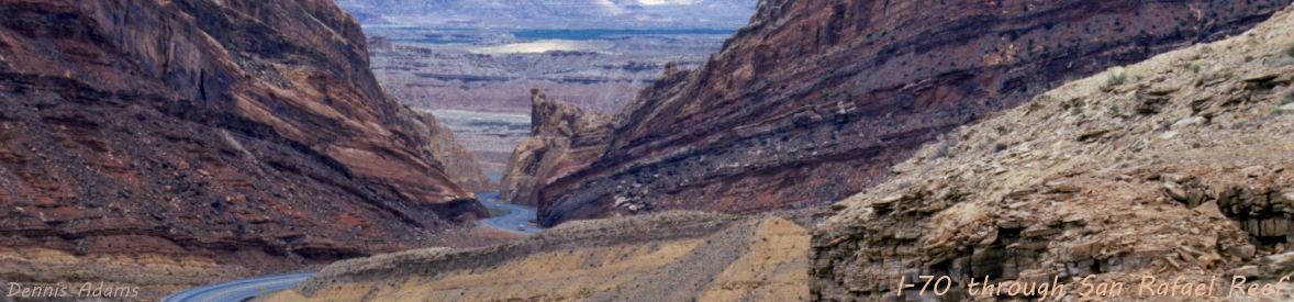
A rancher, referring to the crack in San Rafael Reef where I-70 passes through it (pop up photo), said that before the blasting opened it up for the highway he could stand in that slot canyon and touch both walls by extending my arms.
I-70 through San Rafael Swell is unique in several ways. It charted new territory, going where no roads existed; it is the largest segment of interstate opened at once; and the 110 mile segment between Salina and Green River is the longest stretch of interstate with no services.
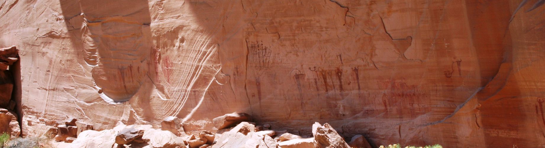
Evidence of Native American cultures, including the Fremont, Paiute, and Ute, is common throughout the San Rafael Swell in the form of pictograph and petroglyph panels. An example is the Buckhorn Draw Pictograph Panel, with rock art left by the Barrier Canyon Culture and the Fremont Culture. From about 1776 to the mid-1850s the Old Spanish Trail trade route passed through (or just north of) the Swell. [wikipedia]
This article doesn't begin to scratch the surface of the rugged beauty and geology of the Swell - petroglyphs, a dinosaur quarry, canyons and slot canyons, rock formations, wilderness and primitive areas, etc. However, if you have stopped at any of the I-70 pullovers in the Swell, no further explanation is necessary - the rugged beauty and scenic vistas speak for themselves.
San Rafael Swell photos are divided into four sections:
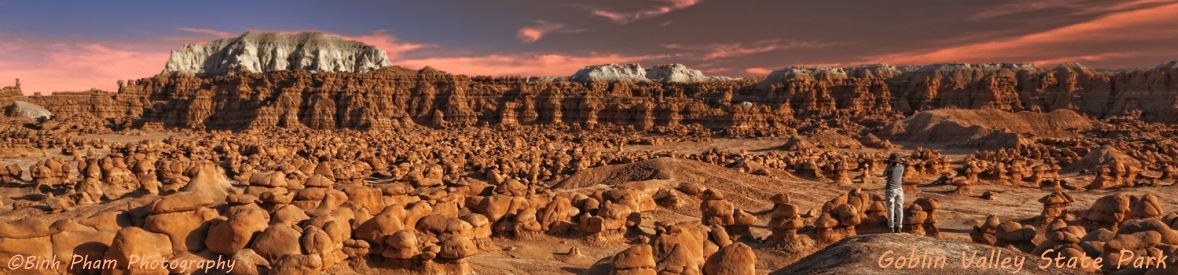
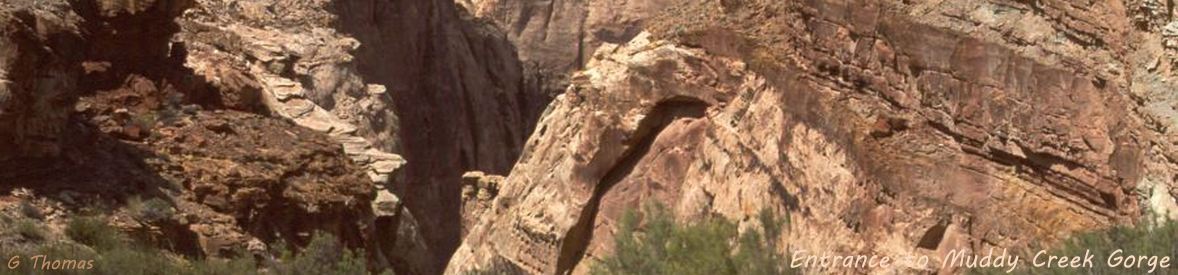
San Rafael Reef runs along the eastern edge of the Swell; Goblin Valley State Park is on the southeast edge of the Swell; Muddy Creek is an ancient 100 mile long waterway predating the formation of the Swell that begins on the eastern slopes of the
Wasatch Plateau at elevations above 10,500 feet (3,200 m) and cuts a path completely across the Swell, with a popular section called the Chute
- at its confluence with the Dirty Devil it has dropped 6,000 feet (1,825 m) in elevation; and Canyons highlights a few of the spectacular canyons in the Swell.
The Photo Gallery presents photos for individual viewing and an auto-show for viewing the photos in a slide show.
Two huge pdfs in the gallery from SanRafaelCountry.com are a San Rafael Country/Emery County map and the Road Less Travelled
self guide to the Swell.
Explore Map is a large pdf map to explore the Swell.
The Google Earth Sat[ellite] View gives an aerial view of this huge anticline.
There are limited information and photos of Goblin Valley here - the geology of, more information about, and more photos of Goblin Valley State Park, including the Goblin's Lair - the Chamber of the Basilisk,
is in the Goblin Valley State Park article.