Canyons of the Ancients National Monument
Canyons of the Ancients National Monument is a national monument protecting an archaeologically-significant landscape located in the southwestern region of the U.S. state of Colorado. The monument was proclaimed in order to preserve the largest concentration of archaeological sites in the United States, primarily Ancestral Puebloan ruins. As of 2005, over 6,000 individual archeological sites had been identified within the monument. Canyons of the Ancients encompasses and surrounds three of the four separate sections of Hovenweep National Monument. [Wikipedia]
Humans have been part of this landscape for at least 10,000 years. The pre-Puebloan people called Basketmakers migrated into the area about 1500 BC. They were primarily hunter-gatherers but, unlike earlier inhabitants, they are associated with the earliest traces of corn agriculture. They excelled at basketry, and interacted with a wider cultural region including Mesa Verde and beyond. By about AD 750 their architecture had developed from pit house clusters into square-roomed "pueblo" style villages. They developed excellent pottery and farmed extensively.
Factors including population growth, soil exhaustion, and changing rain/snow patterns began to reduce the natural resources of the area. By about 1300 AD the Ancestral Puebloans had migrated south, east, and west to where their descendants live today as the modern Native Indians in the Four Corners area. Some archaeologists refer to a suspected 23-year drought as a possible cause of their migration. [in part, from the BLM]
This monument is huge with thousands of sites.
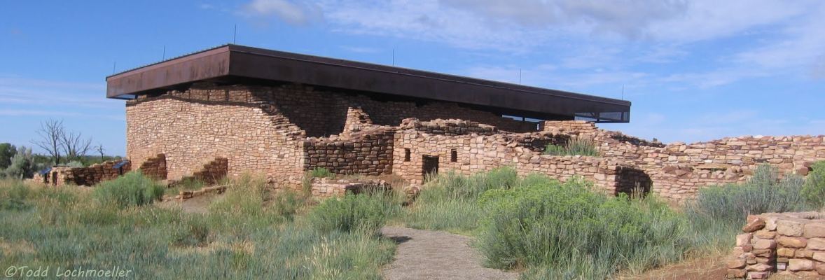
We have photos from Todd Lochmoeller's  Four Corners Hikes gallery (new window) of many photos, with others from different sources, to highlight this rugged area, an extensive archaeological and cultural record.
The Photo Gallery contains photos of Canyons of the Ancients with an auto-show of the photos in the gallery.
The Large pdf map is a huge pdf map from the BLM that may take some time to load and open; you can zoom in significantly to an area of interest without distortion using Reader's + and - buttons. The Smaller map is an image map, smaller han the pdf version, and without the legend and auxillary information in the pdf map.