Fruita bridge opened in 1907, one pier started to sink before finished but opened anyway and stayed open until 1970
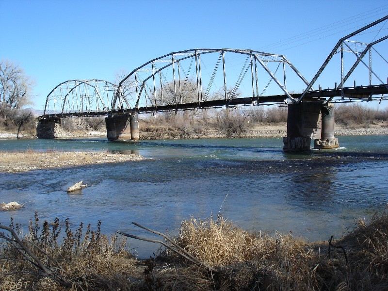
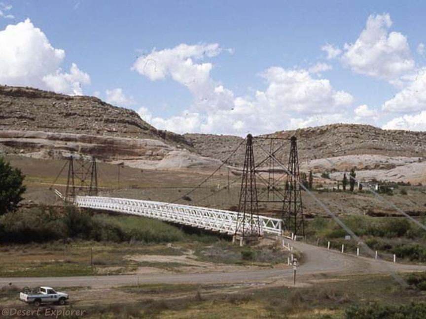
A side view of the Fruita bridge
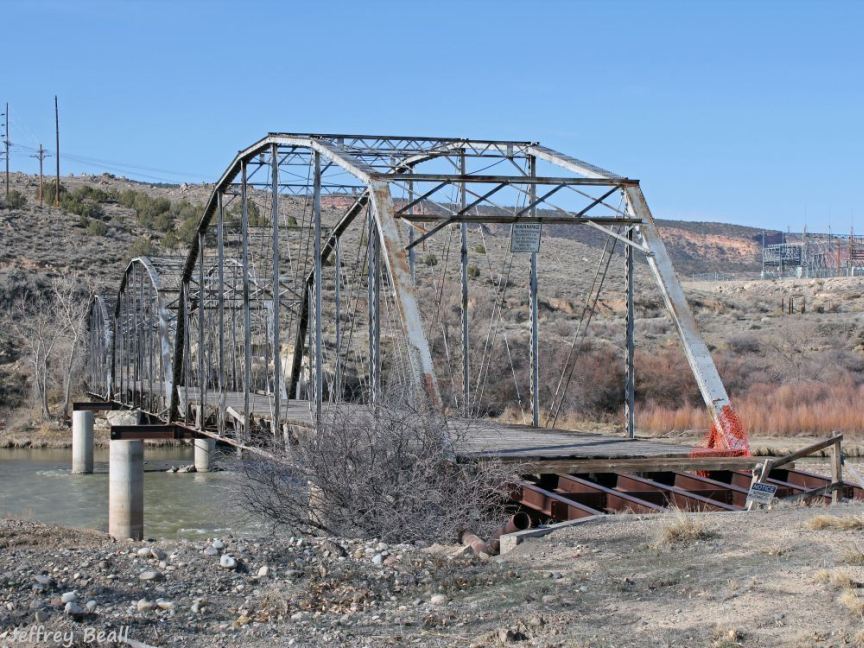
The Fruita bridge with new piers and support system to preserve this remarkable structure
Fruita bridge after the fire of July 9, 2018, presumably caused by a careless camper
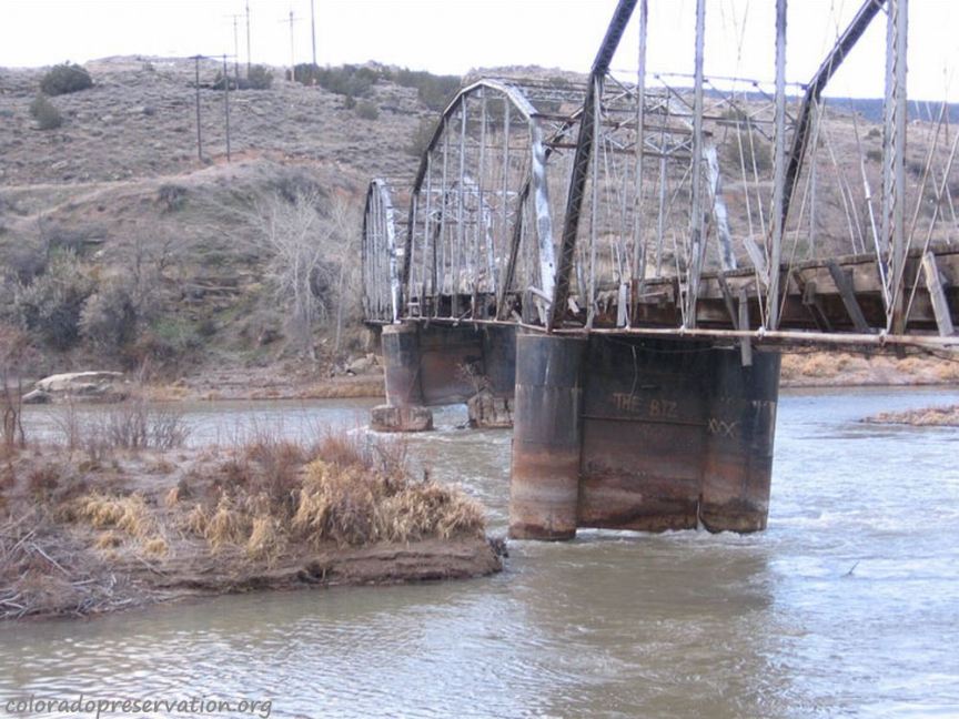
The original Dewey bridge, built in 1916, date of the photo is April, 2007
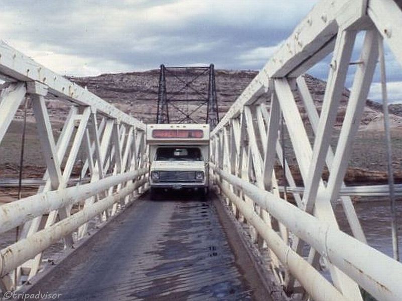
The Dewey bridge is a tight fit ffor a camper
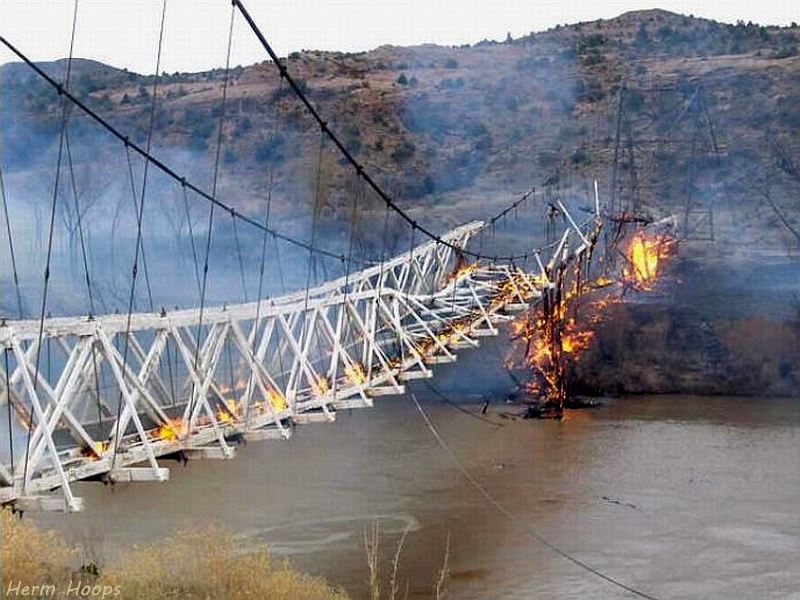
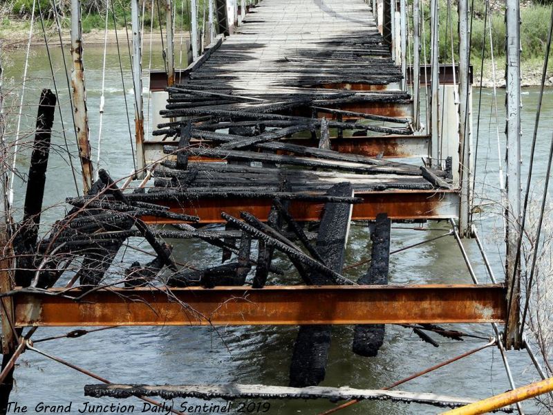
The burning Dewey bridge on April 6-7, 2008
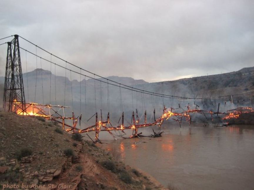
The burning Dewey bridge on April 6-7, 2008
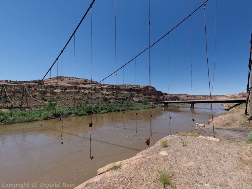
Remaining frame of the 1916 Dewey suspension bridge which burned in April 2008, new bridge in the background
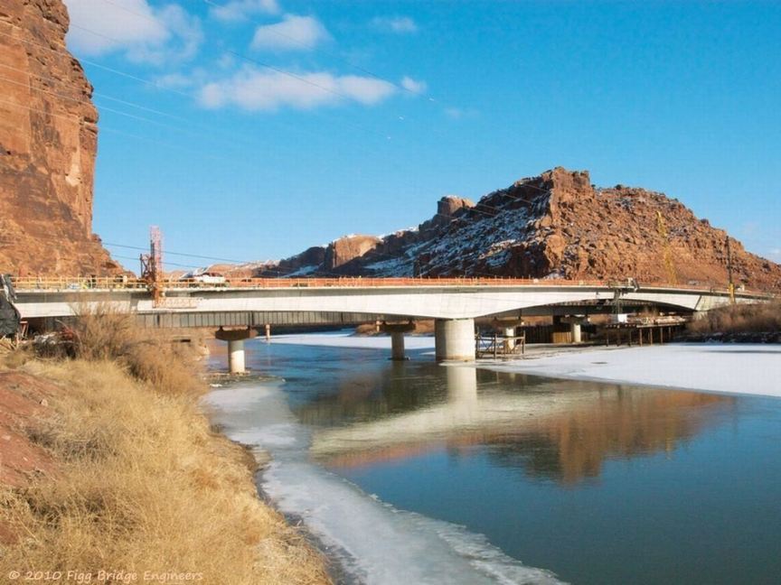
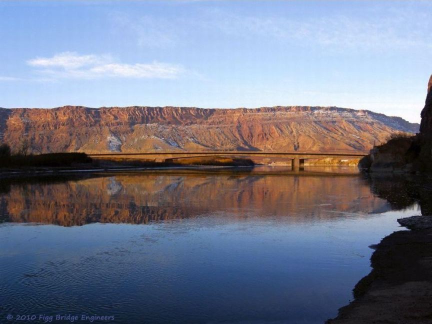
The old bridge is visible (and in use) behind the south-bound bridge under construction
South-bound is open, north-bound under construction; unique geology in the background
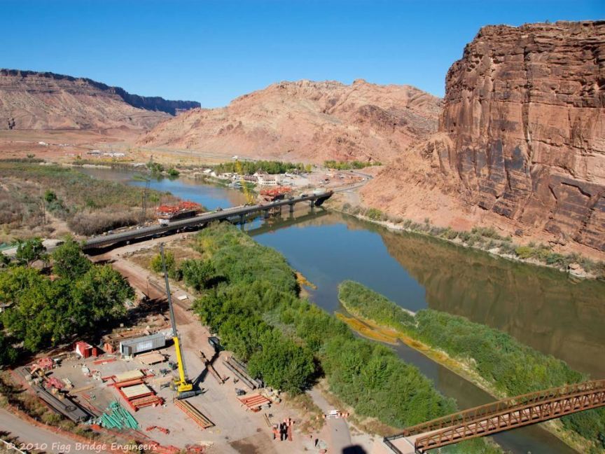
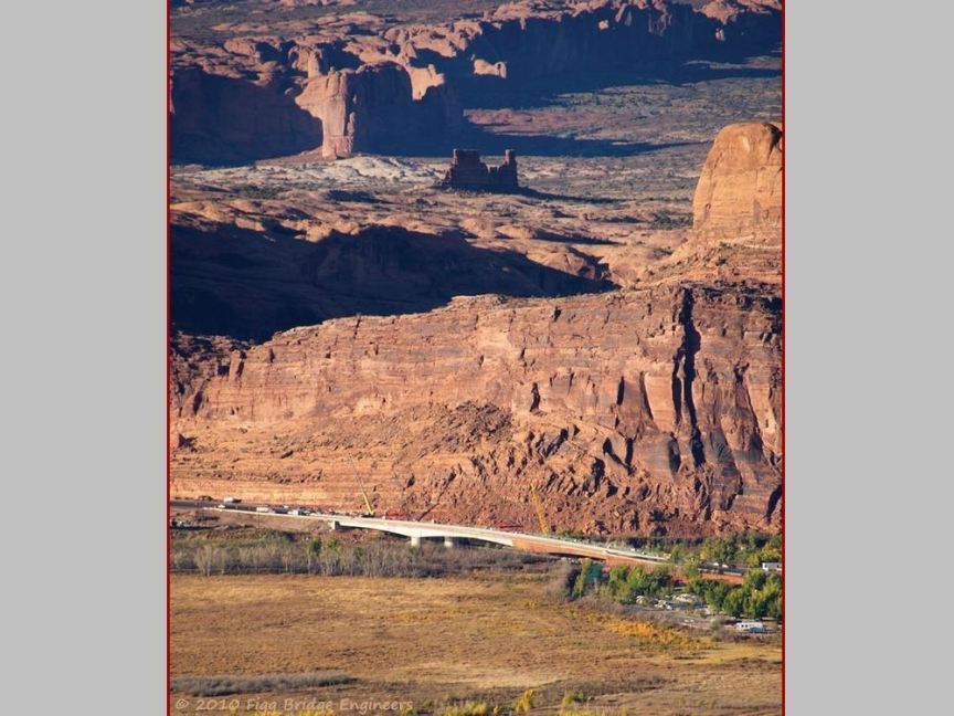
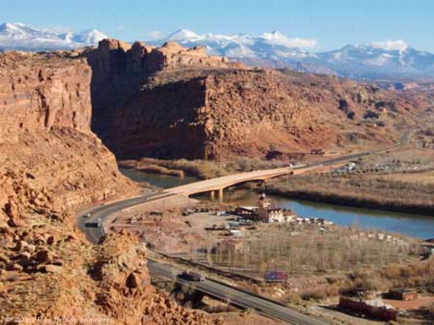
Aerial view of the Colorado River Bridge under construction
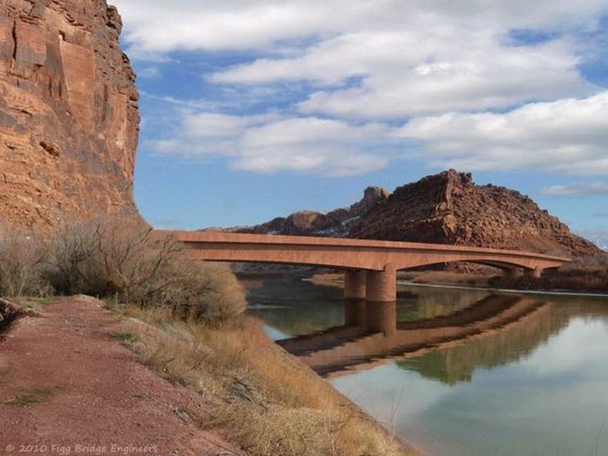
The finished bridge blending into the environment in daylight
The US191 Colorado River Bridge blending into the environment at sunrise
Aerial view of the finished Colorado River Bridge
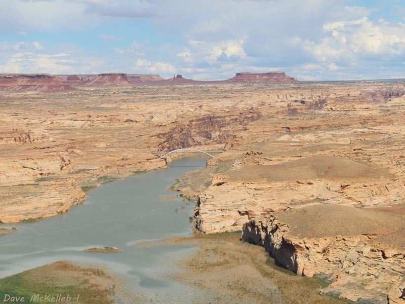
Bridge approach showing the dry Colorado & Lake Powell, insert is a mini-copy of the original before it was cropped
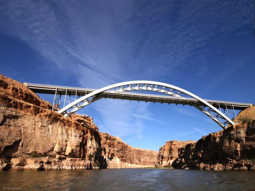
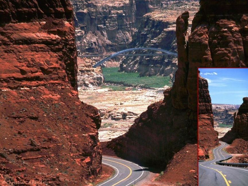
Panoramic view through the bridge into Cataract Canyon from the surface of Lake Powell
View from Hite Overlook of the bridge in front of Cataract Canyon and Colorado Plateau geology
Crop of Mr. Mehlfȕhrer's panorama; the panorama photo is in the gallery
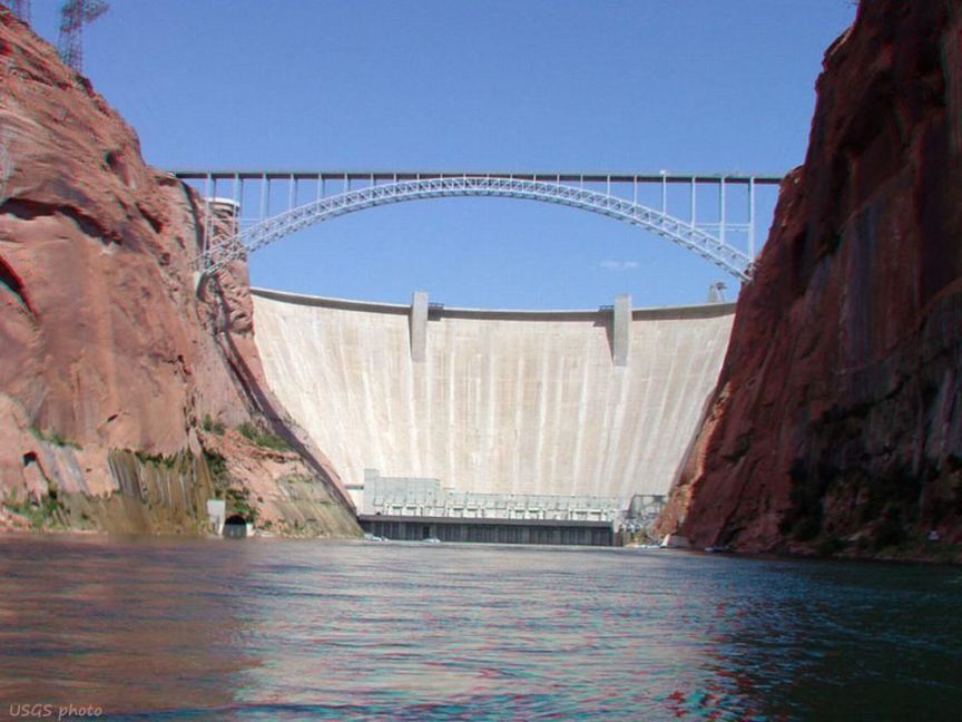
Photo from USGS of Glen Canyon Dam bridge and the dam, from the Colorado
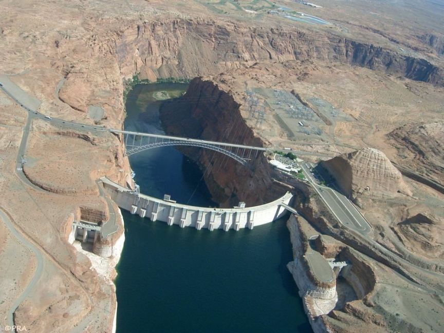
Aerial view of Lake Powell and Glen Canyon Dam, Bridge, and Canyon
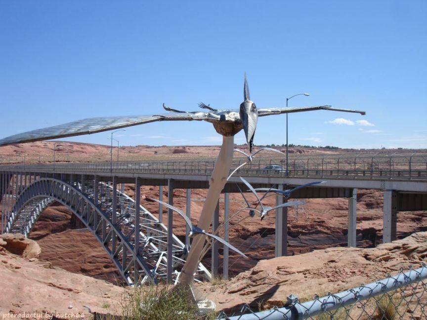
Construction of the dam yielded Pterodactyl fossils, now celebrated in a metal sculpture at the visitors center
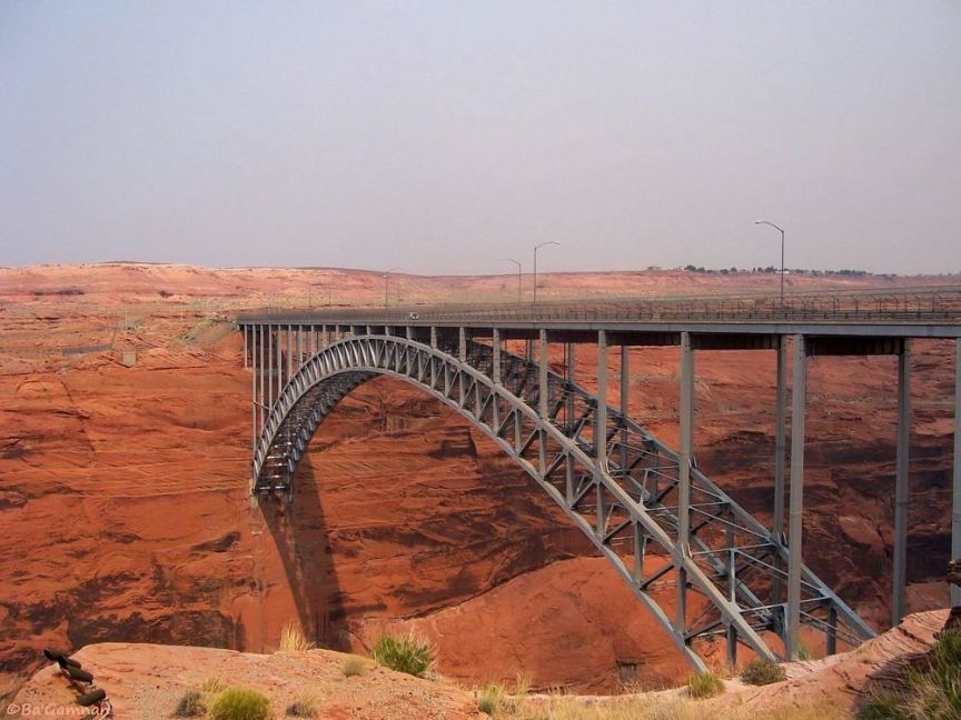
Scenic view of the bridge by Ba'Gamnan
Scenic view of the bridge, cropped from a wide anlge view. The wide-angle view is in the gallery.
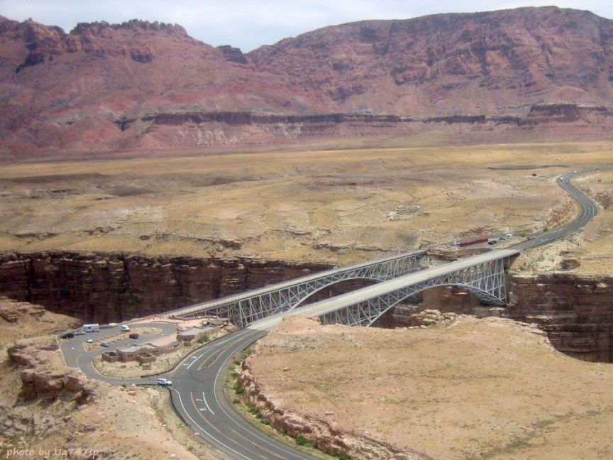
An aerial view of the bridge and Navajo Interpretive Center, Echo Peak on the left
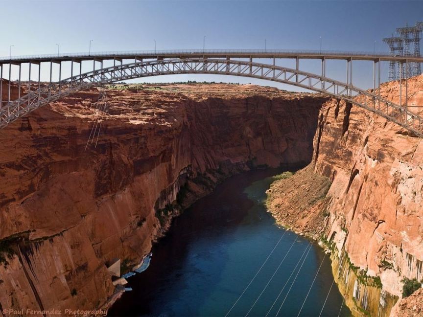
An aerial view across the bridge into Marble Canyon

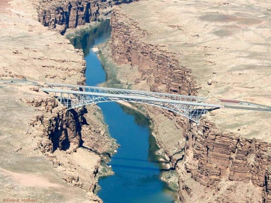
A view of the bridge from below on the Colorado in Marble Canyon
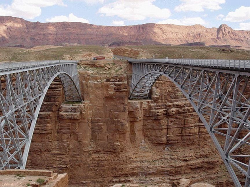
The new bridge on the right, historic bridge on the left, Echo Cliffs in the background
Overhead view of the River Trail overlook, trail bridges, and of Bright Angel Canyon
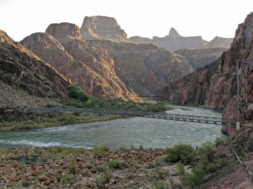
View of both bridges from the trail
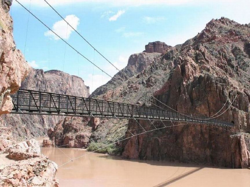
Kaibab Bridge, the black bridge, used by mules and hikers, and on the Arizona Scenic Trail
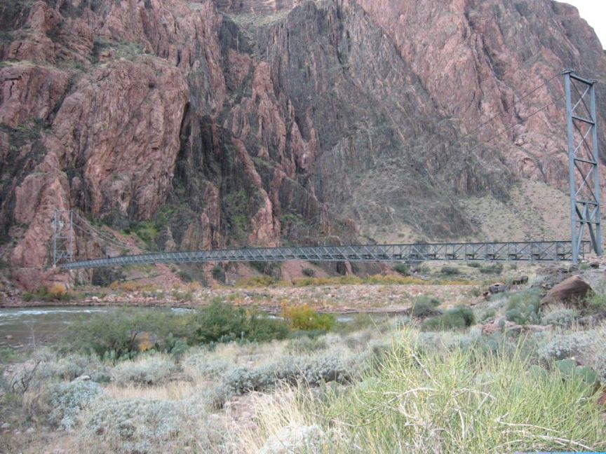
Bright Angel Bridge, silver bridge, also carries the transcanyon pipeline that supplies south rim water
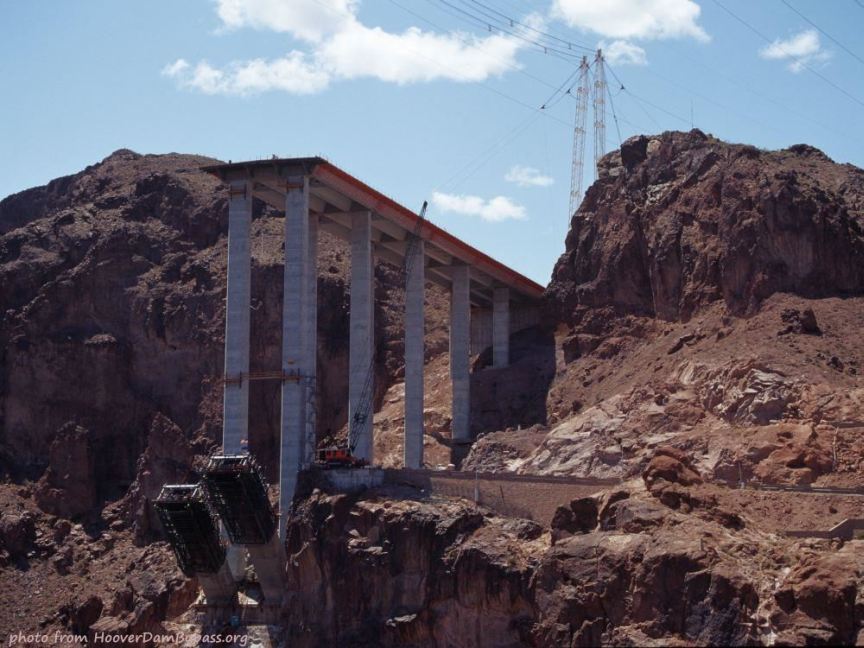
Early construction on the Nevada side in March 2008
Building the cable support (next photo) in June 2008 - insert is a mini-copy of the original
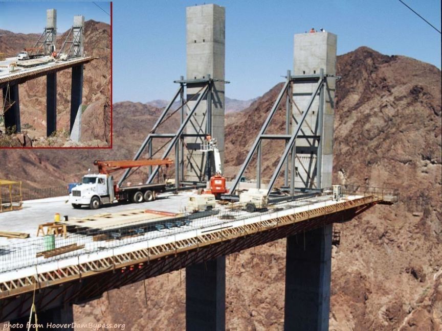
Interesting how they do this! June 2009

The arch nears completeion, September 2009, looking into Nevada
Overhead view into Arizona of construction progress - March 2010
Bridge floor is almost done - May 2010
The floor is done and cured (heavy stuff on it) - August 2010
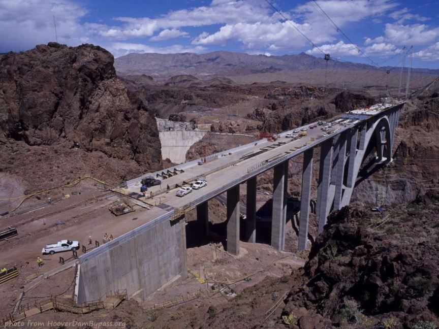
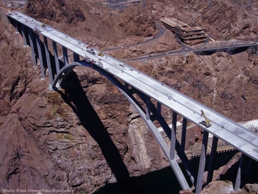
Overhead view of construction progress, approach paving not finished - August 2010
View into Nevada - August 2010 - bridge nearing completion (opens in October)
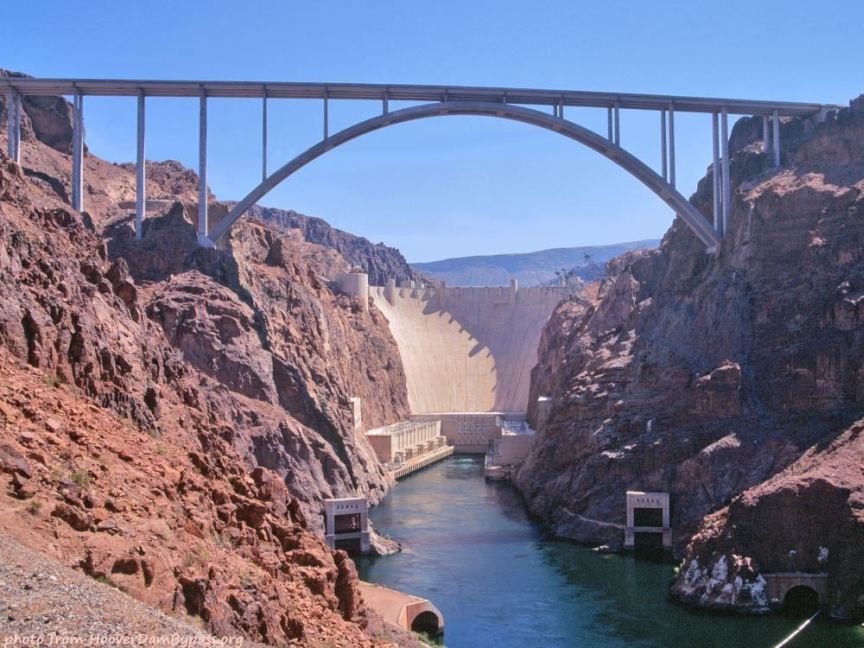
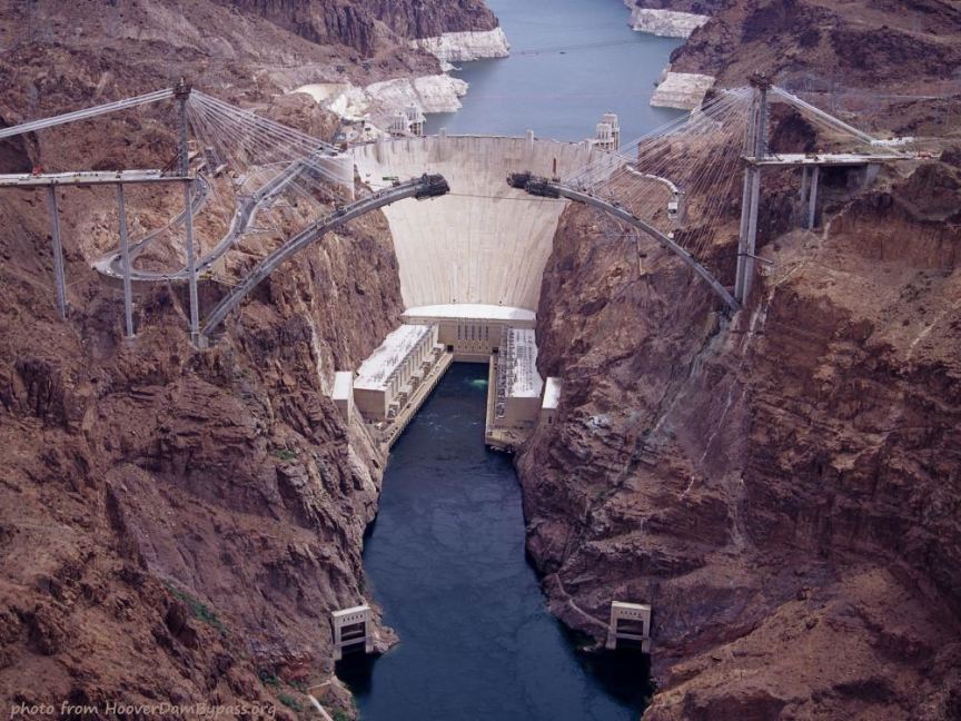
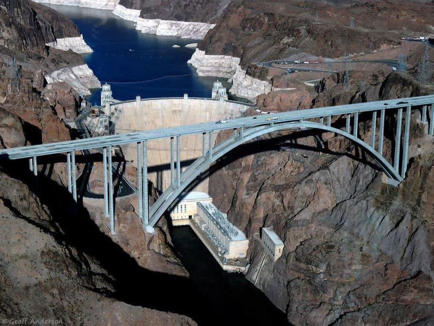
View of Hoover Dam through/under the Hoover Dam Bypass Bridge
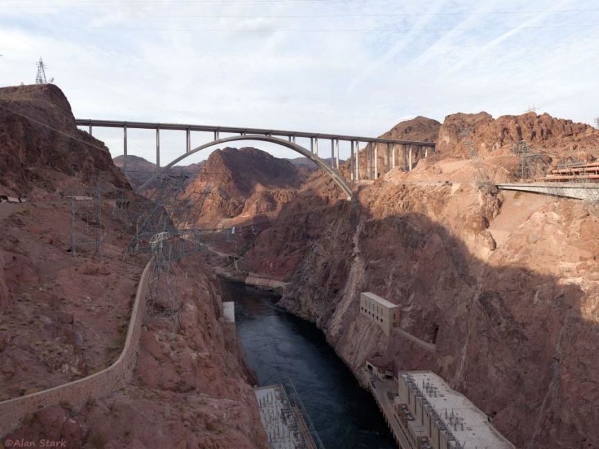
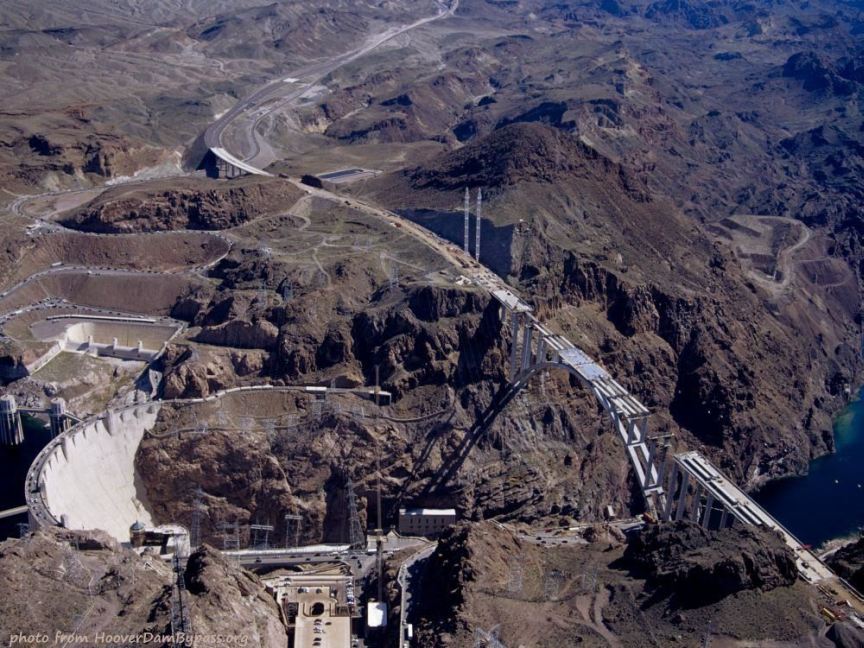
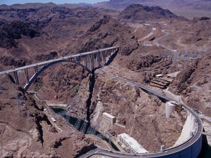
View of the US93 Hoover Dam Bypass Bridge and Black Canyon from Hoover Dam
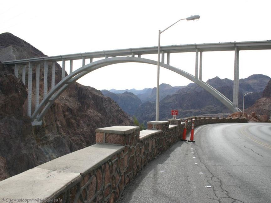
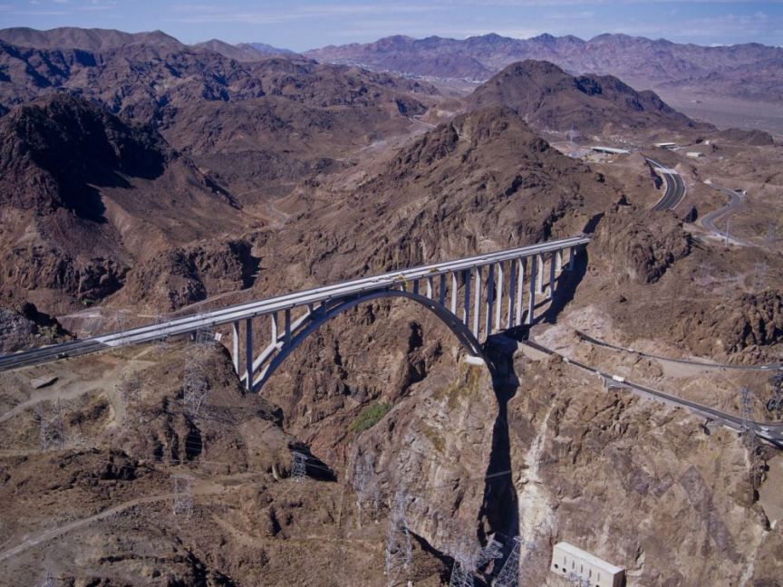
View of the bridge from old US93 - the road to Hoover Dam

The walkway on the side of the bridge, 900' above the Colorado
Overhead view of the bridge and Black Canyon (in strange lighting)
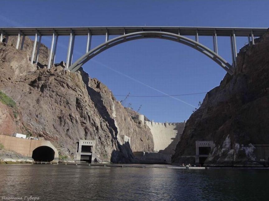
View of the Hoover Dam Bypass Bridge and Hoover Dam from the surface of the Colorado
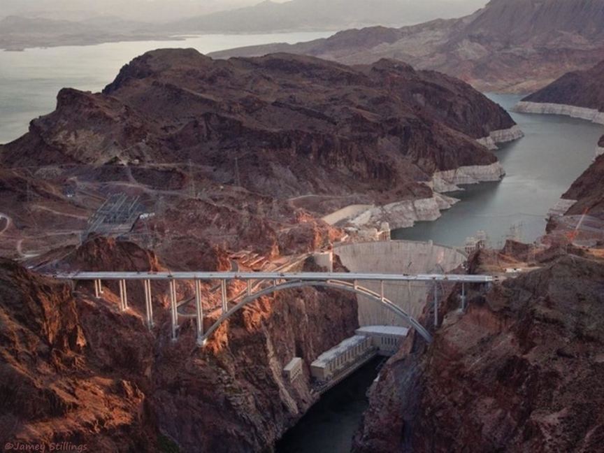
Aerial view of the Mike O'Callaghan-Pat Tillman Memorial Bridge, Hoover Dam, and Lake Mead
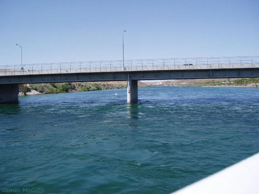
View of the Laughlin bridge across the Colorado built in 1987 by casino owner Don Laughlin
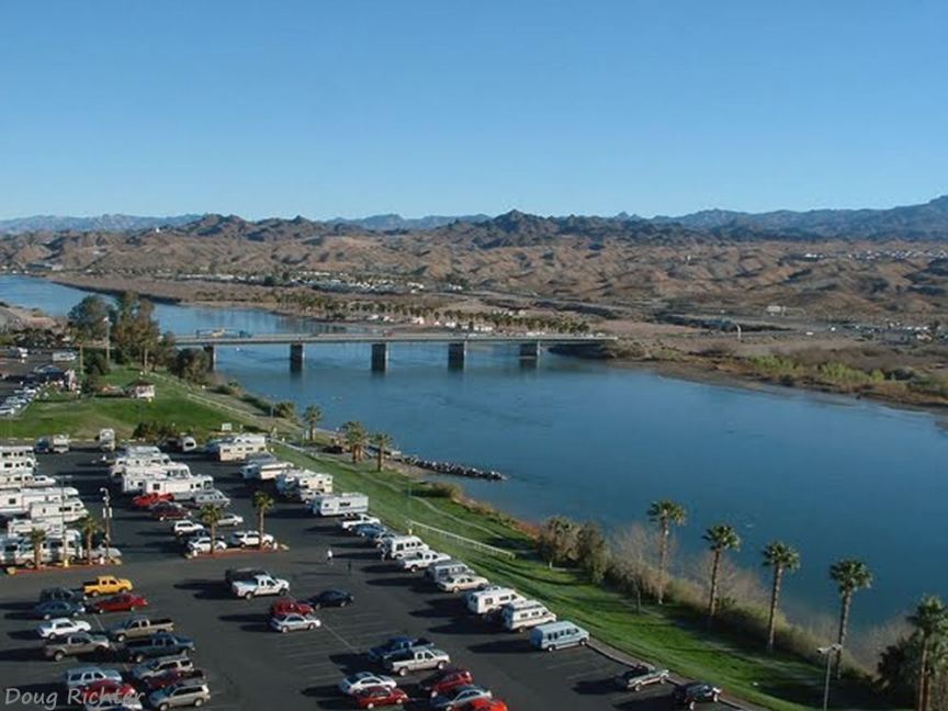
View of the Colorado and the bridge at Laughlin from the Riverside Resort Hotel & Casino
Military guard at Red Rock bridge during WWII (1943)
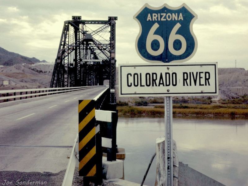
View of the Red Rock bridge after the rails and ties were removed and it was converted in 1947 to handle US 66 traffic
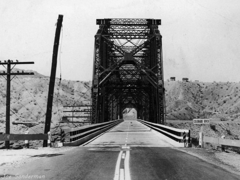
1956 photo of US 66 crossing the Red Rock bridge into California
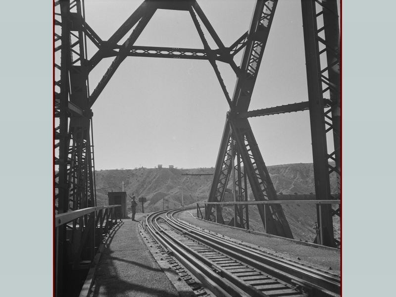
This is a very bad photo or a very good painting - the detail is almost too good to be a painting?; it shows trains on
both bridges between the time the Santa Fe bridge was built and the Red Rock bridge was converted to carry US 66
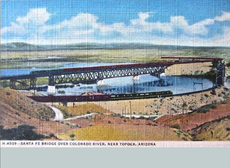
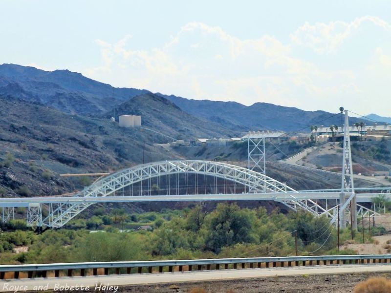
The Sante Fe railroad bridge and the Red Rock bridge now used for US 66
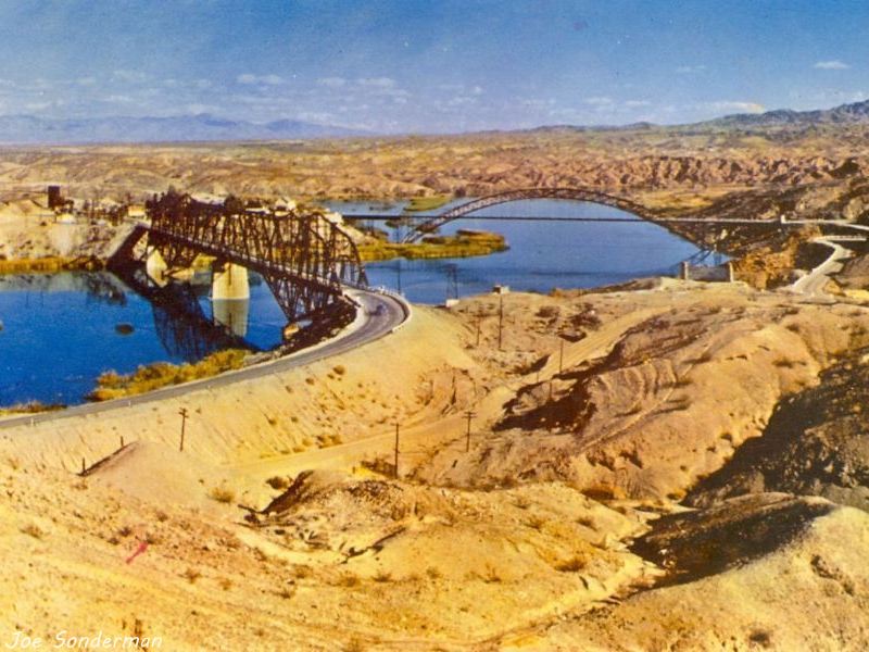
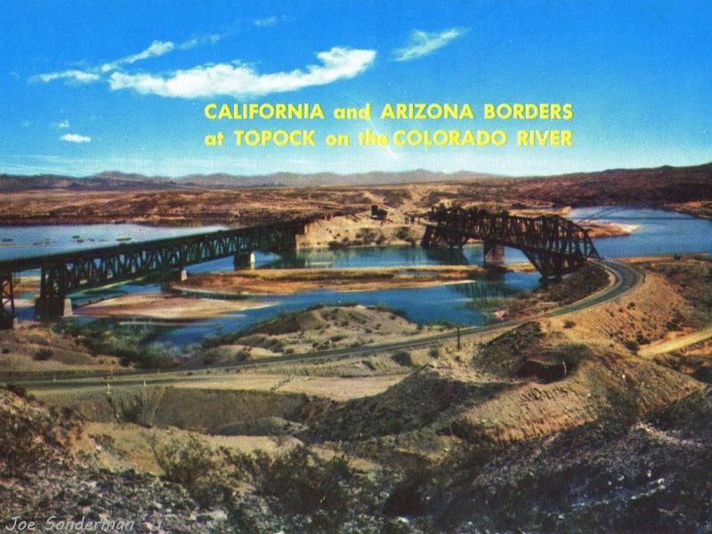
The Red Rock bridge and Old Trails bridge crossing the Colorado between Arizona and California
The Old Trails bridge was built in 1916 for the Old Trails National Road, a precursor to US66
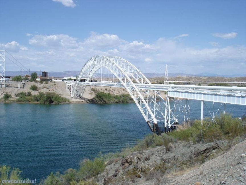
US 66 traffic was moved to the Red Rock bridge in 1947, Old Trails now carries a natural gas pipline
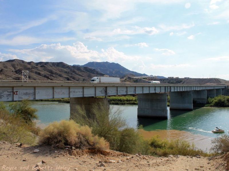
The I-40 (and US66) bridge was built in 1966, retiring the Red Rock bridge which was dismantled in 1976
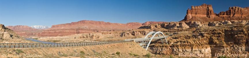
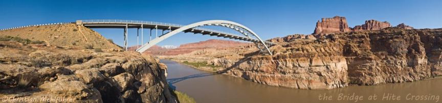
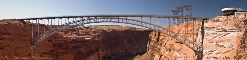
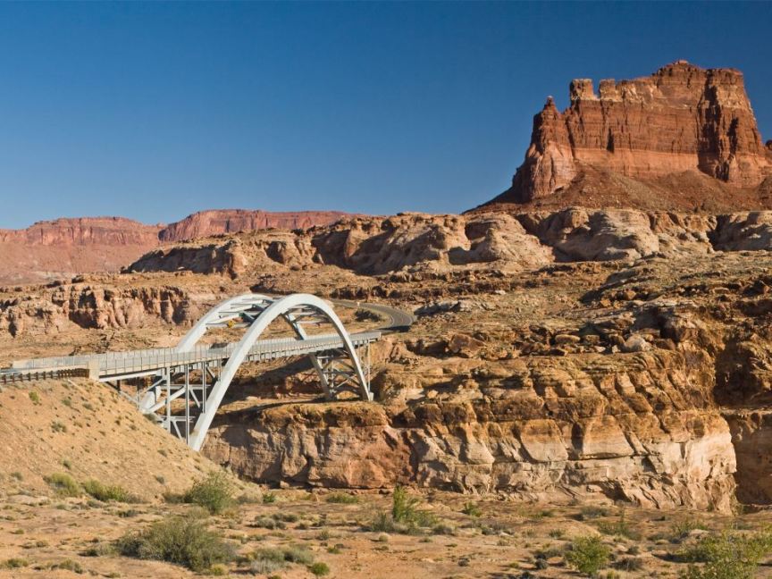
Two panoramic views of the bridge at Hite Crossing and one of the Glen Canyon Dam Bridge
Larger versions of the panoramas are in the photo gallery