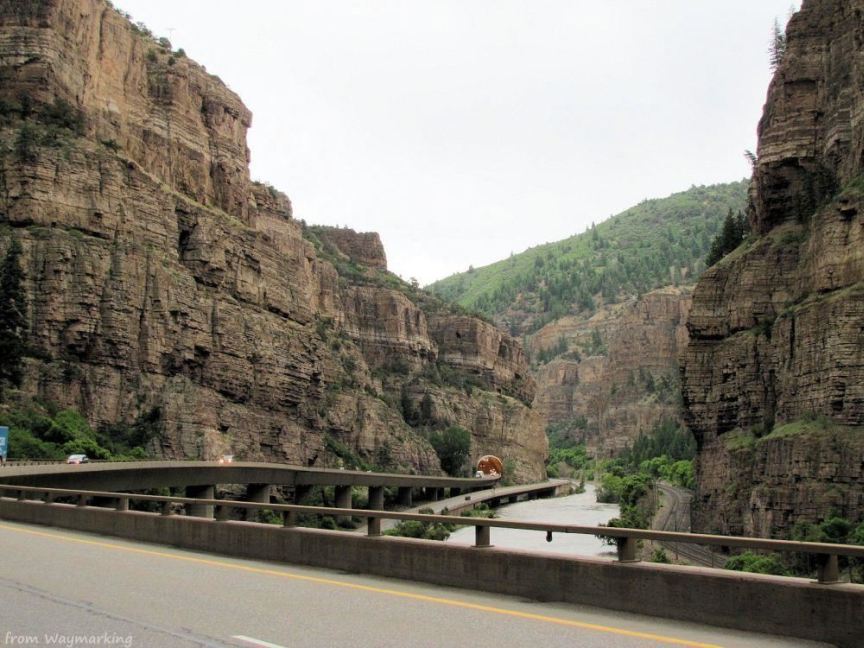
Westbound I-70 climbing up the viaduct from Reverse Curve Tunnel at the eastern end of Glenwood Canyon
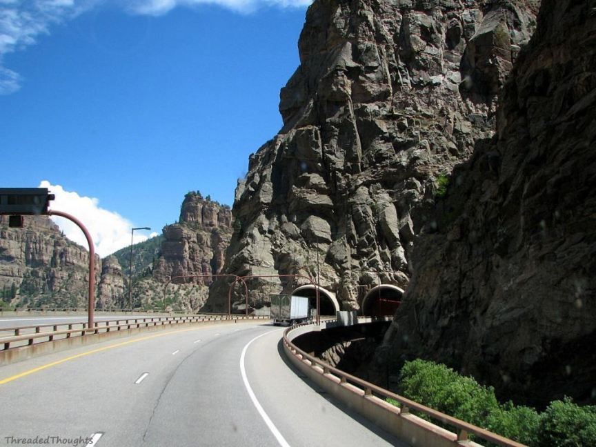
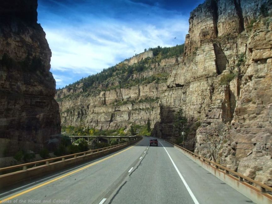
West portal into Hanging Lake Tunnel on I-70 in Glenwood Canyon
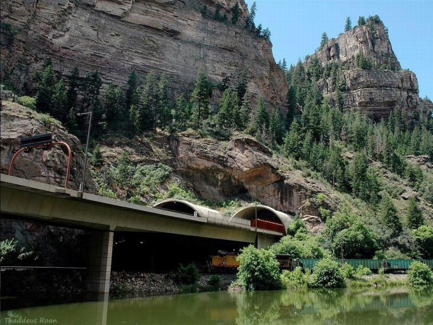
Triple-stack in Hanging Lake Tunnel - Colorado River under Union Pacific train under Interstate 70
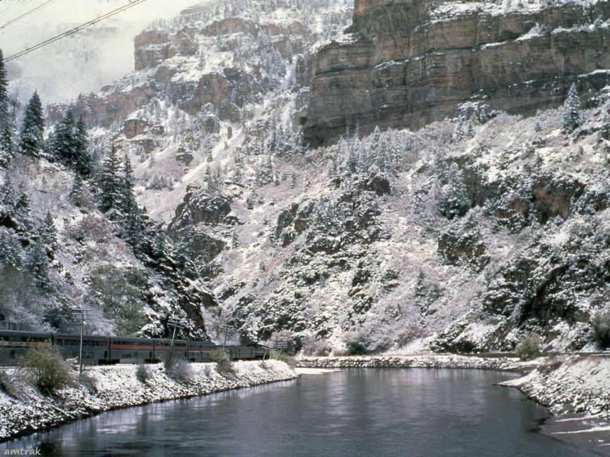
Amtrak's California Zephyr, Colorado River, and US 6 in Glenwood Canyon in the 1980s, before I-70 was constructed
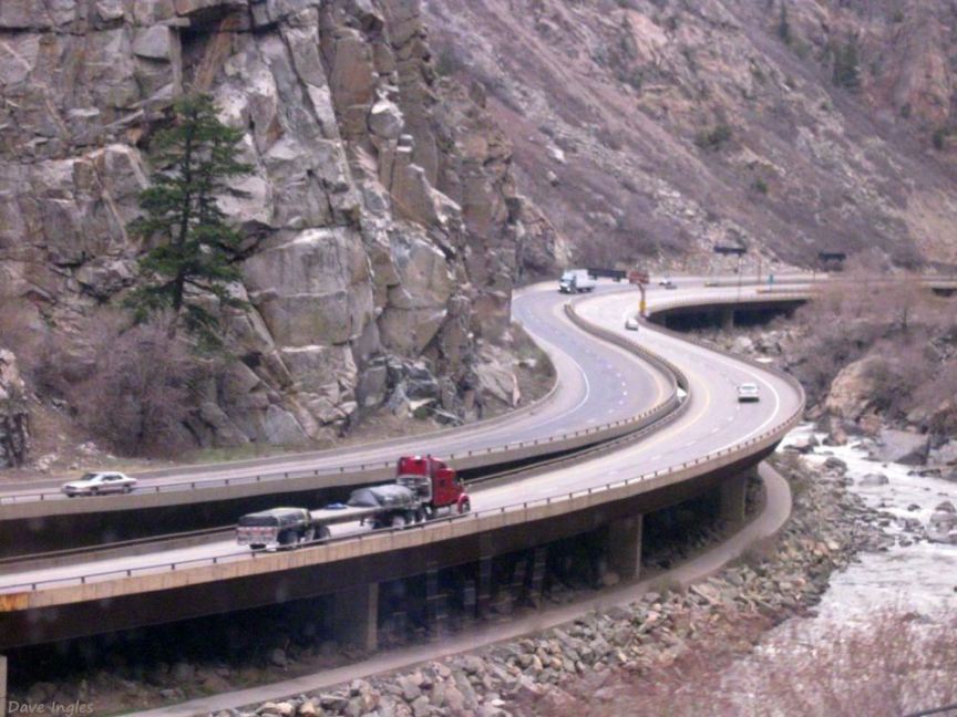
Photo from the California Zephyr train of the viaduct in Glenwood Canyon
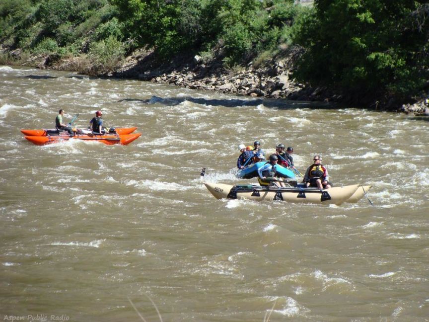
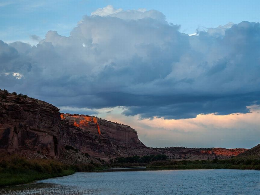
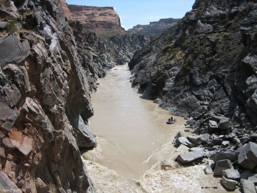
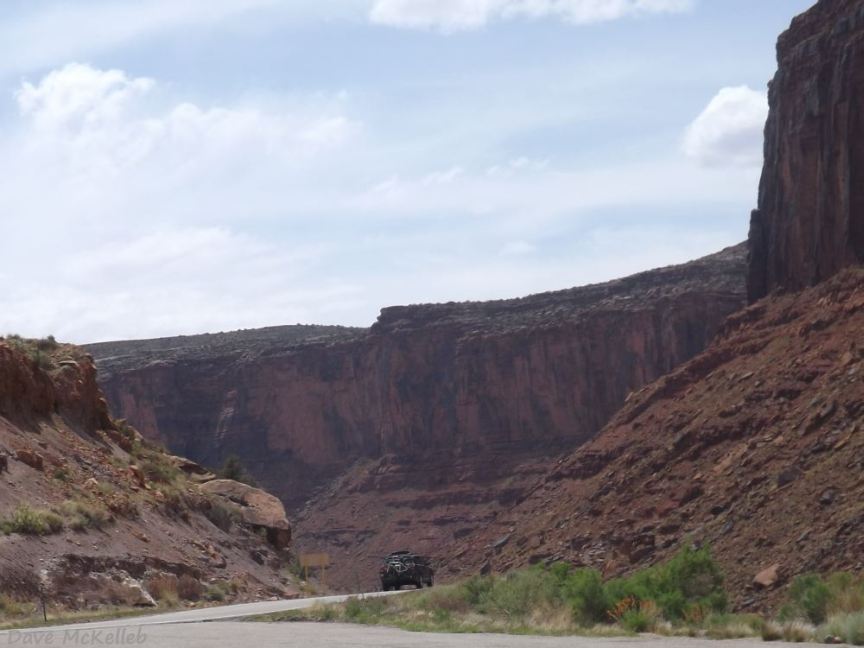
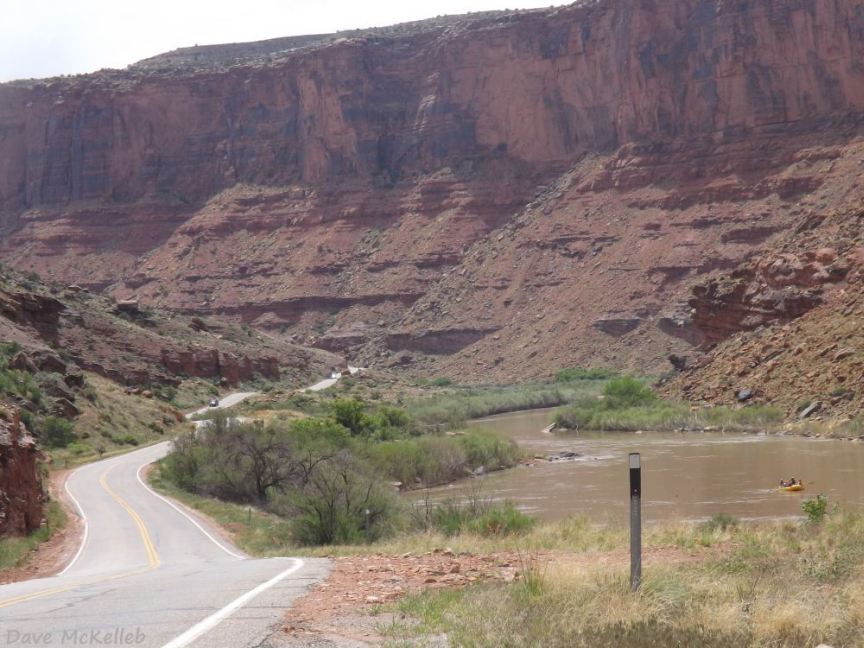
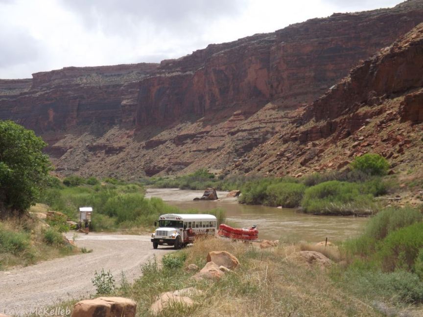
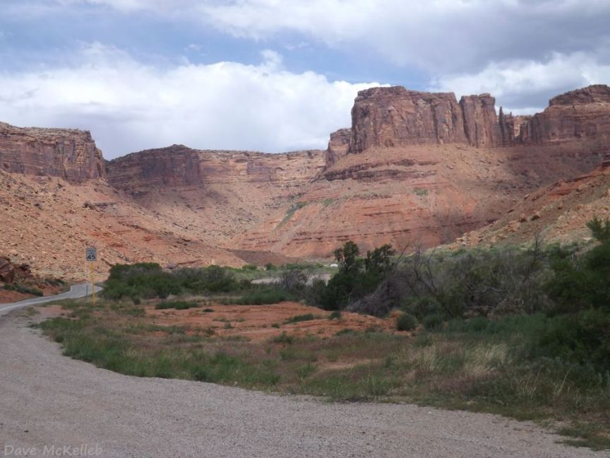
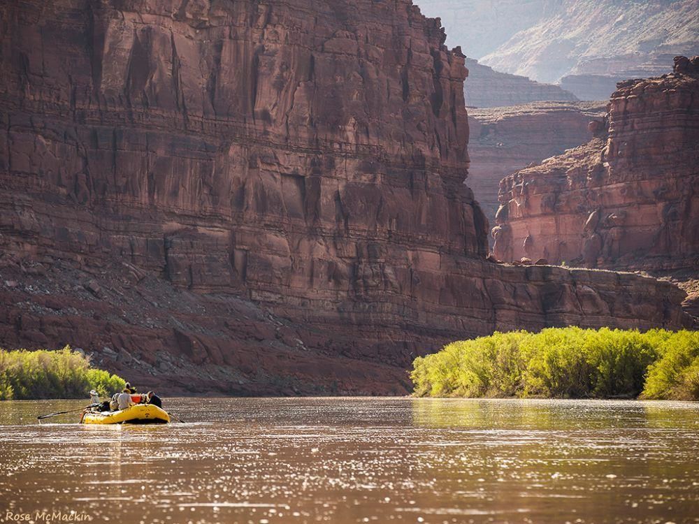
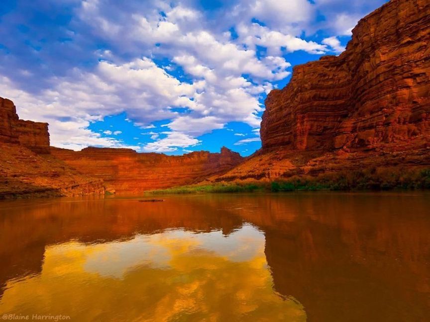
Rafting Glenwood Canyon
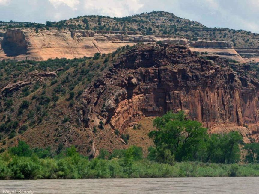
Titled: I-70 in De Beque Canyon,
there is no viaduct in DeBeque, this is in Glenwood Canyon
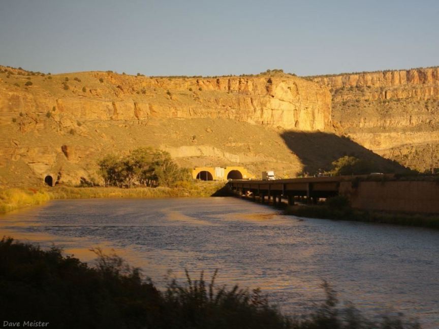
Beavertail Mountain tunnel in De Beque Canyon at sunrise; taken from the California Zephyr
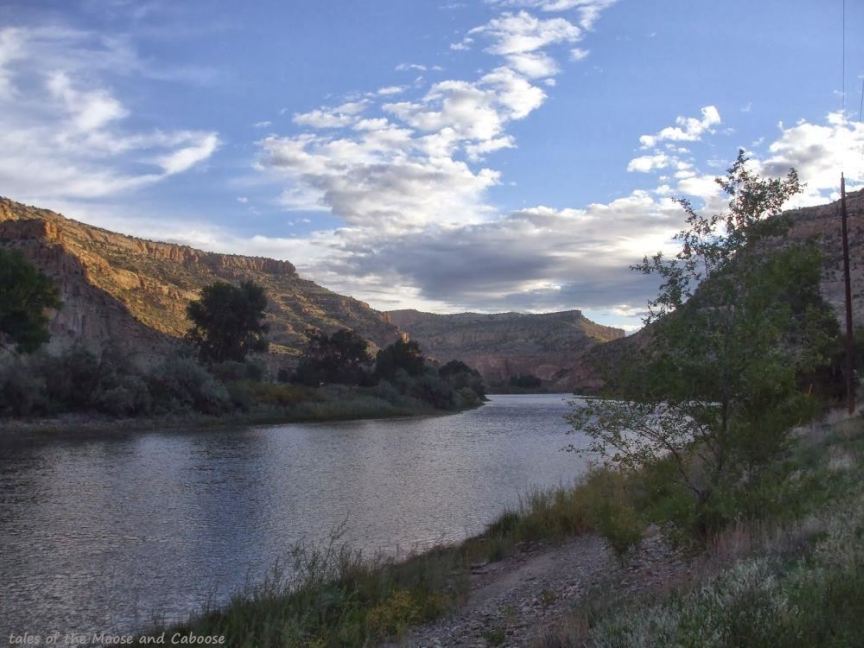
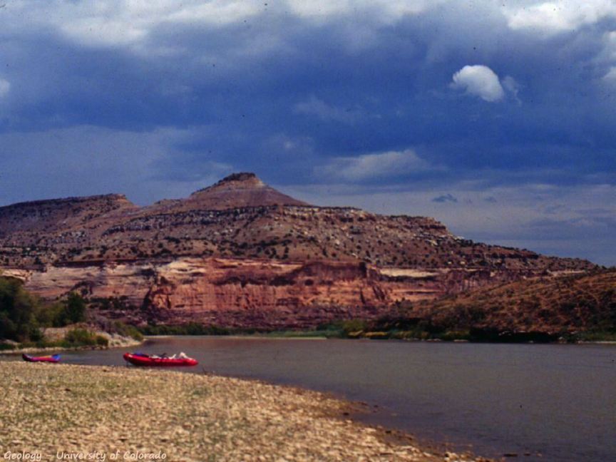
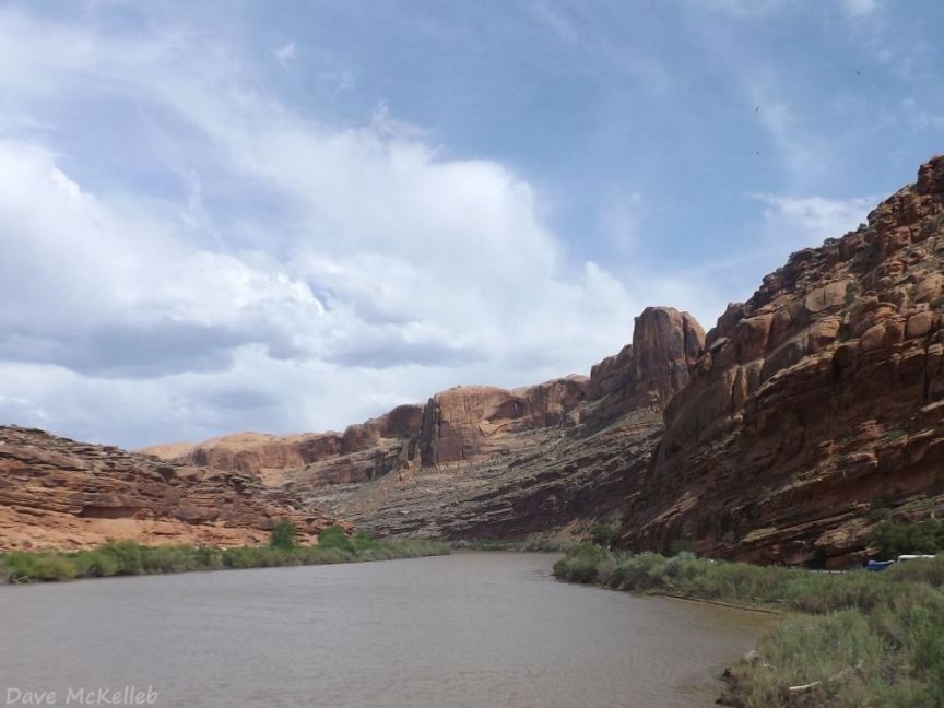
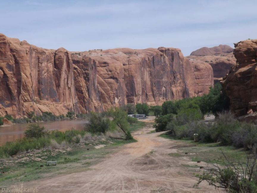
De Beque Canyon from Island Acres Campground, between De Beque and Palisade, < 20 miles east of Grand Junction
Island Acres Campgound in the Island Acres section of Colorado River State Park
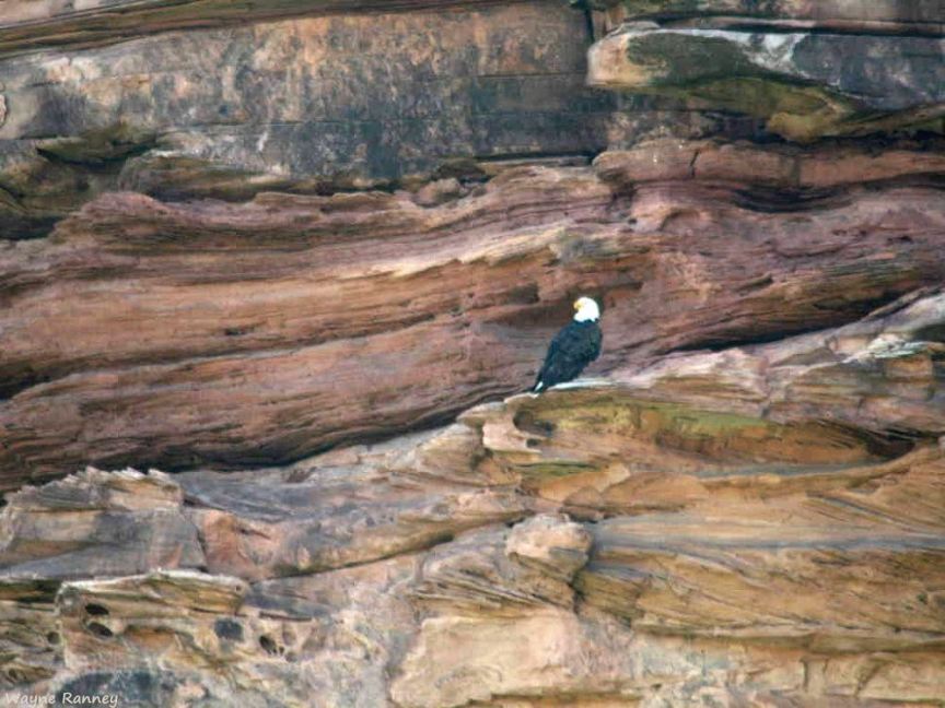
A mature bald eagle stood sentinel at the entrance to Horsethief Canyon
the Rattlesnake monocline, where the strata were compressed and upturned during the Laramide orogeny
I like the way the setting sun just lit up two small sections of the cliffs in the distance
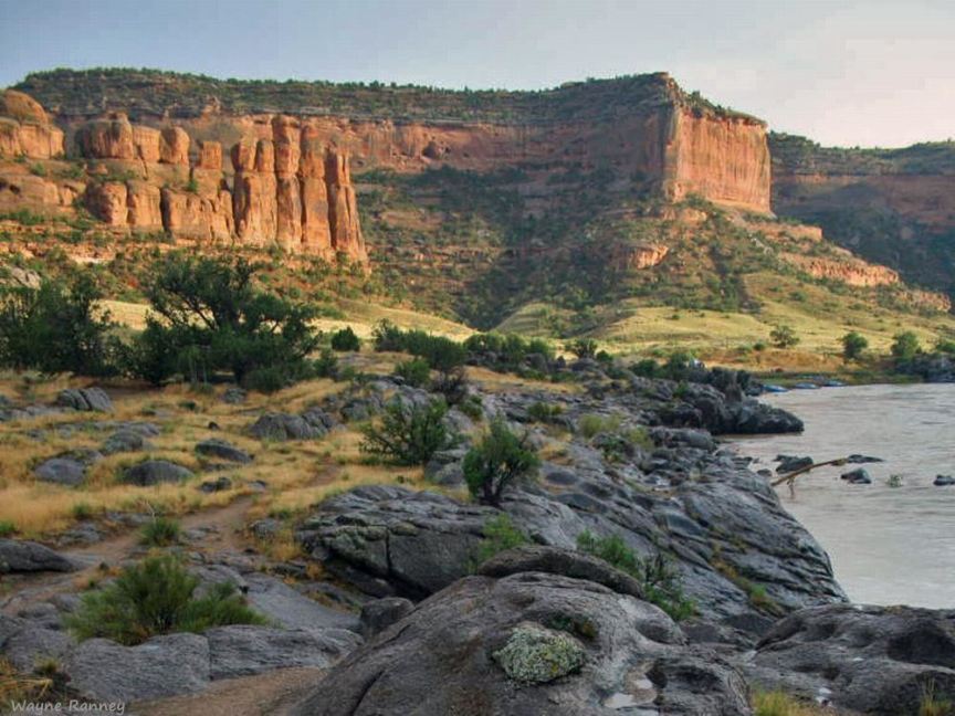
[Ruby Canyon]
Gravel bar in Ruby-Horsethief Canyon
Black rocks on a Steamy morning after a night of rain in Ruby...
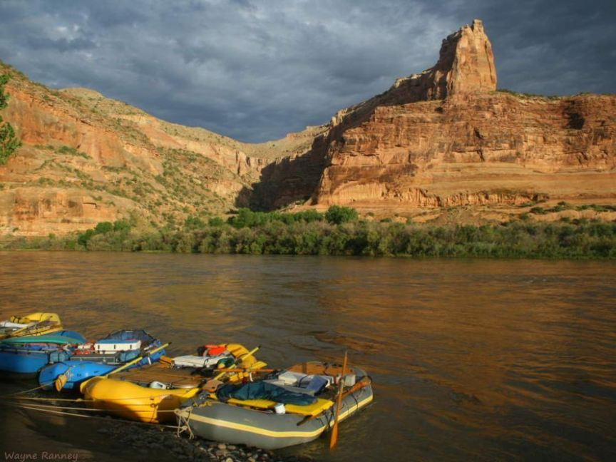
I took this picture at sunrise of our rafts in Mee Corner camp
[Ruby Canyon]
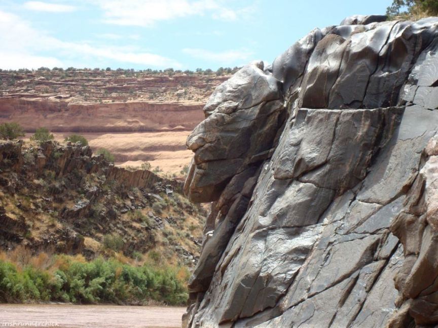
Demon Face,
on the canyon wall entering Westwater Canyon
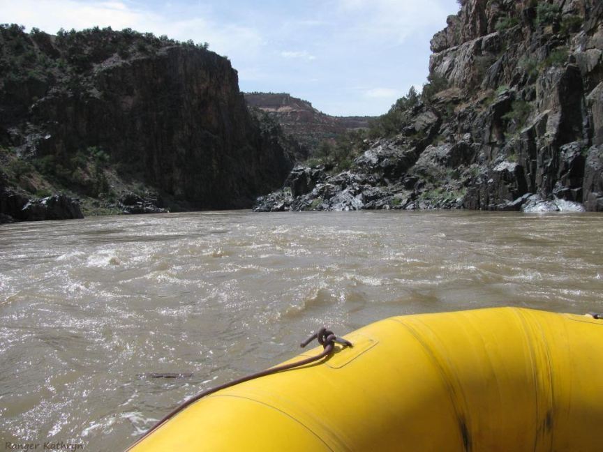
Ranger Kathryn in Westwater Canyon; the canyon is 17 miles long with no mid-canyon take-out
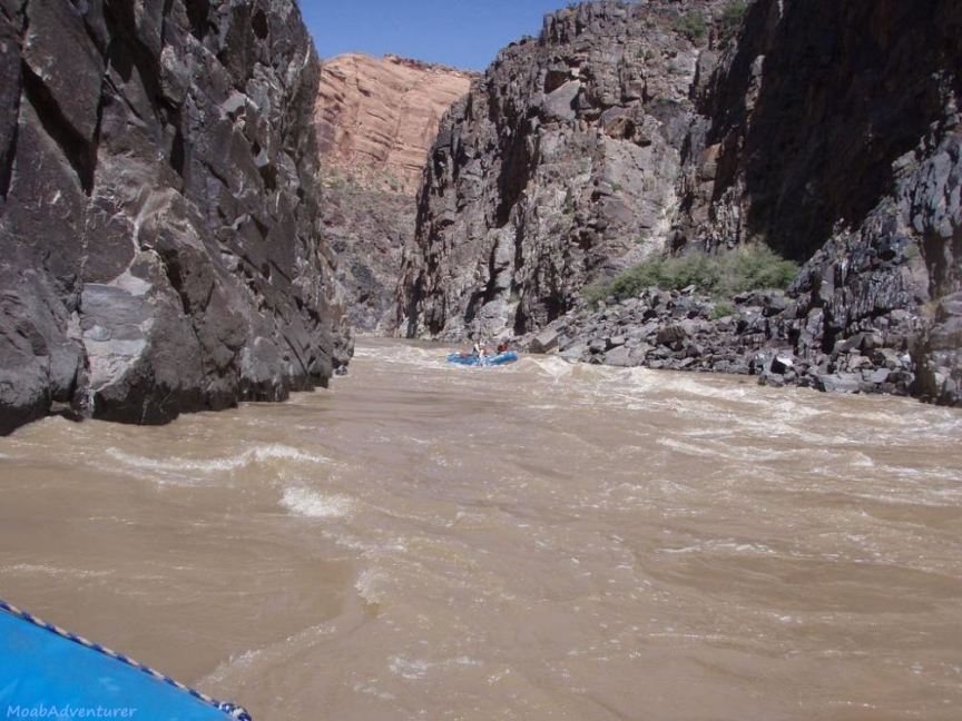
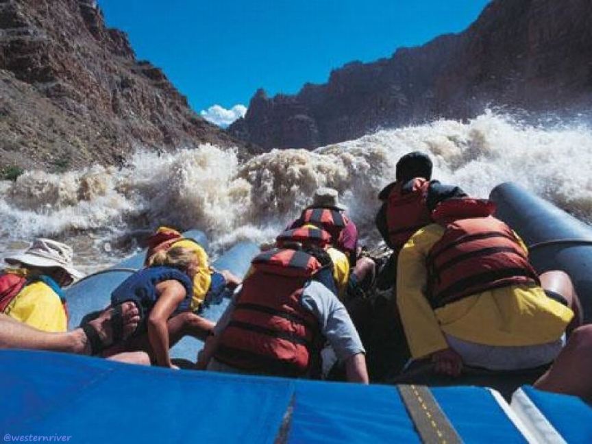
In the rapids of Westwater Canyon
A narrow section of Westwater Canyon inside wicked black rock canyon walls
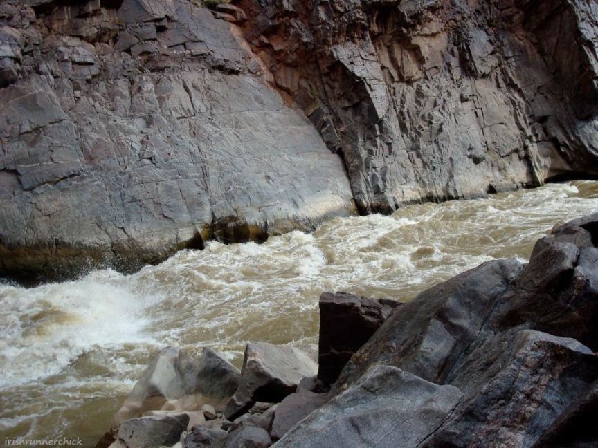
Approaching Skull Rapid in Westwater Canyon
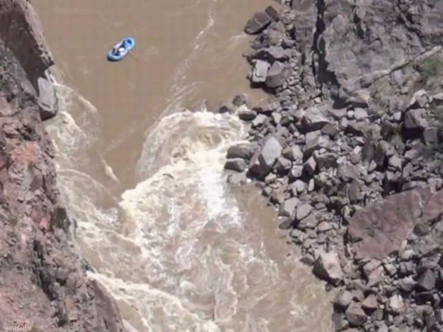
A rafter going into Skull Rapid; from a YouTube video from above the rapid - a link to the video is in the gallery
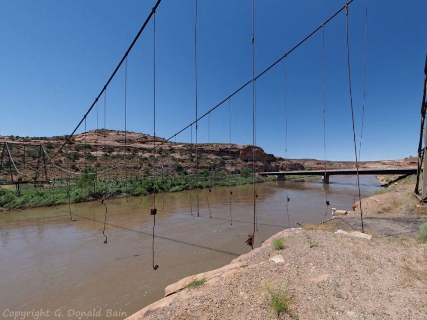
The remaining frame of the 1916 Dewey suspension bridge which burned in 2008, at the entry into no-name canyon 1
View of the north canyon wall downstream a little distance from Dewey
View of Scenic Byway 128 in the canyon
View down the canyon with the La Sal Mountains behind the canyon wall in the distance
Leaving the canyon, entering Professor Valley with some amazing geology
Scenic view of geology in Professor Valley
Entering no-name canyon 2, the gorge of the BLM's Colorado River Byway
Looking down the gorge toward US191 and Moab
Boat/raft take-out ramp along the Colorado River
Geology of the Colorado River Byway gorge, nearing US191 and Moab
View east up the end of canyon 2 from the Colorado Riverway trail bridge
Meander Canyon near Moab, the south side of the Colorado on BLM 114 off Kane Creek Blvd in Moab
Meander Canyon - 60 miles of quiet water from Moab to Green River (class I rapid 2 mi north of the confluence)
Peaceful Colorado River in scenic Meander Canyon near Moab, Utah, inside Canyonlands National Park
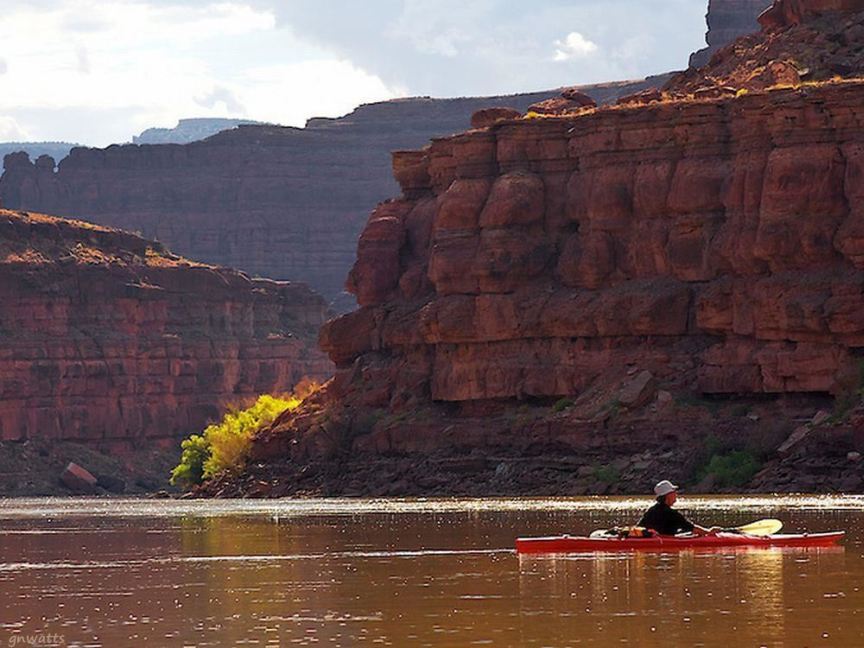
Kayak on the Colorado in Meander Canyon
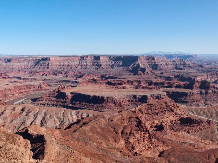
View from Dead Horse Point of Meander Canyon inside Canyonlands National Park
Cataract Canyon Sunrise
on the Colorado in Cataract Canyon from NPS
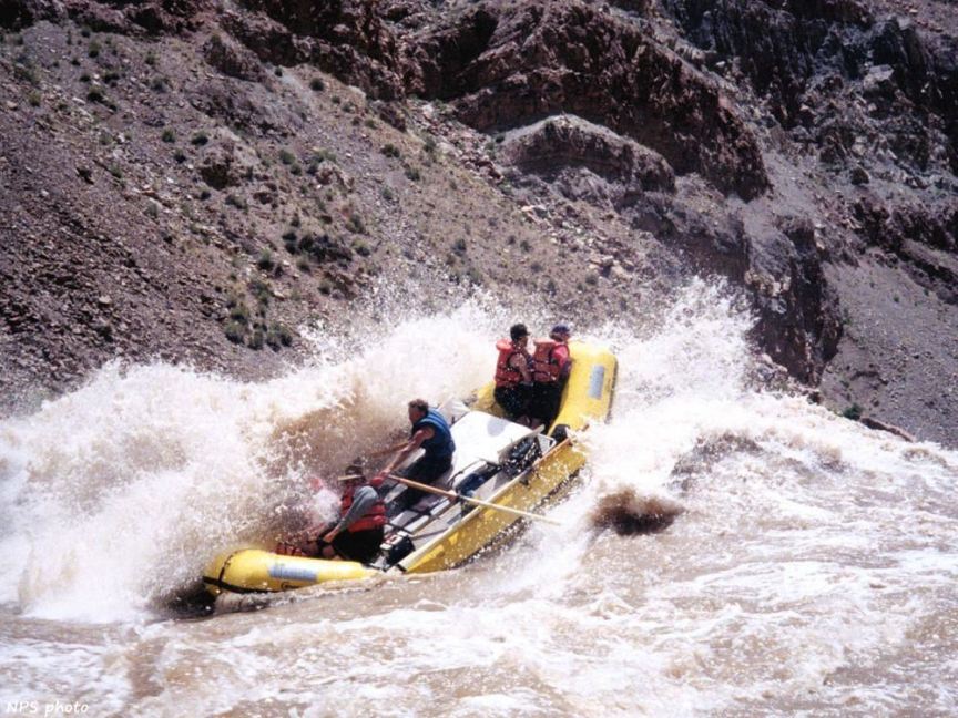
Whitewater rafting - 14 miles of rapids ranging in difficulty to Class V in the hazardous and isolated Cataract Canyon
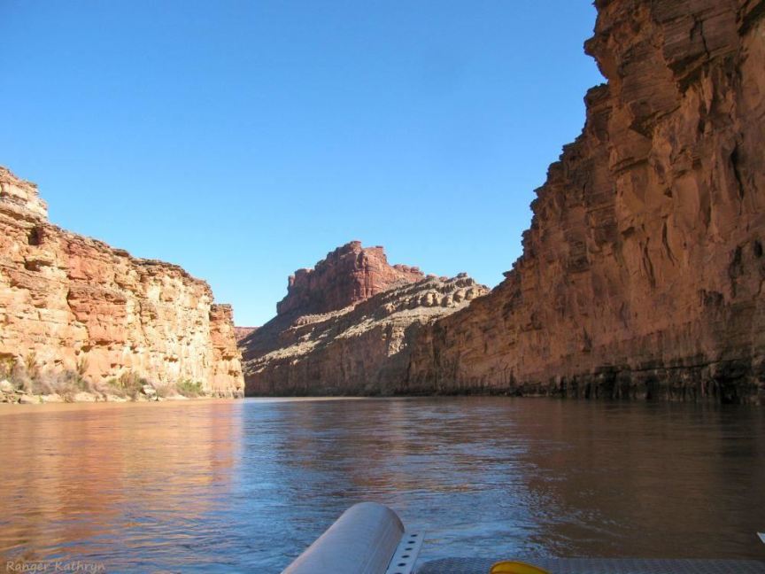
Photo in Cataract Canyon by NPS Park Ranger Kathryn
Whitewater rafting in the extreme on the Colorado in Cataract Canyon
Sunrise on the Colorado at Spanish Bottom in Cataract Canyon
Massive canyon walls of Glen canyon at its junction with Cataract & Dirty Devil Canyons at the Bridge at Hite Crossing
bath tub rings
on the walls of Glen Canyon in Lake Powell illustrate the depth of the Colorado River Basin drought
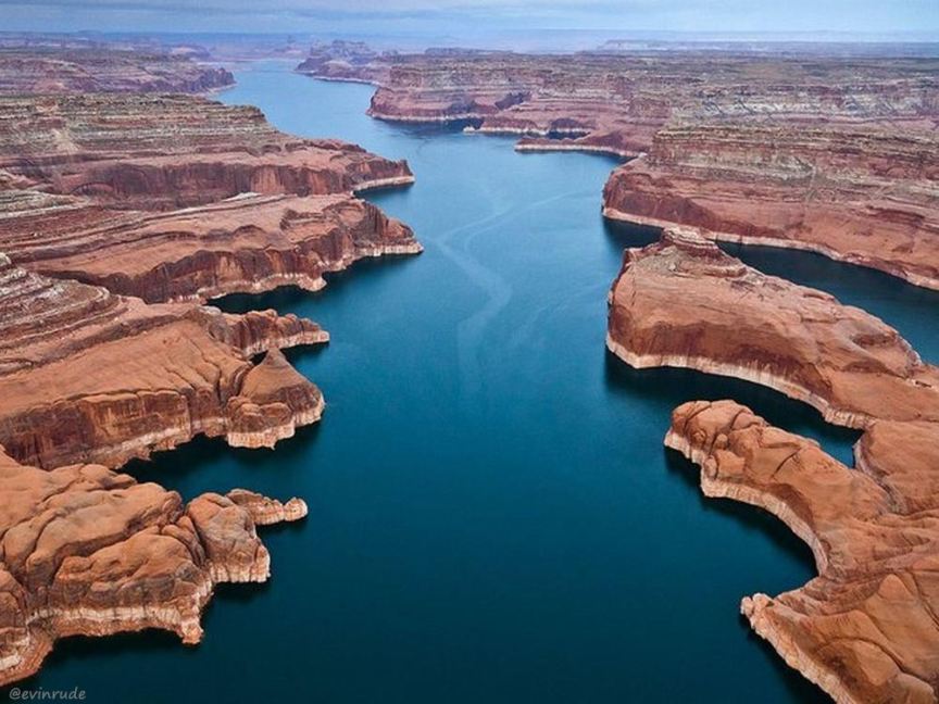
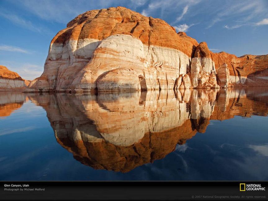
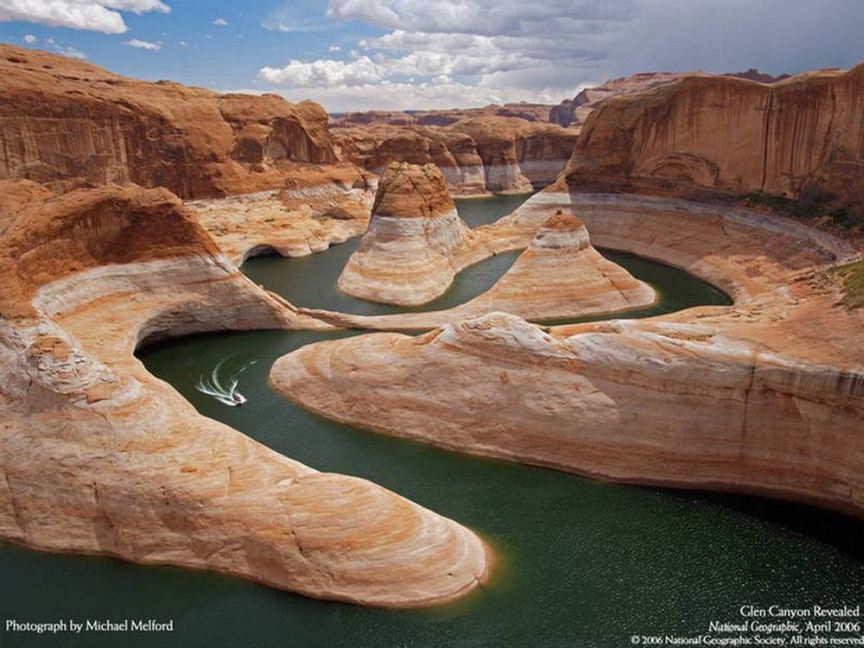
Main channel of the Colorado River and Lake Powell covers 186 miles (299 km) of Glen Canyon
More bath tub rings
in the junction of San Juan and Glen Canyons - try to picture Glen Canyon before Lake Powell?
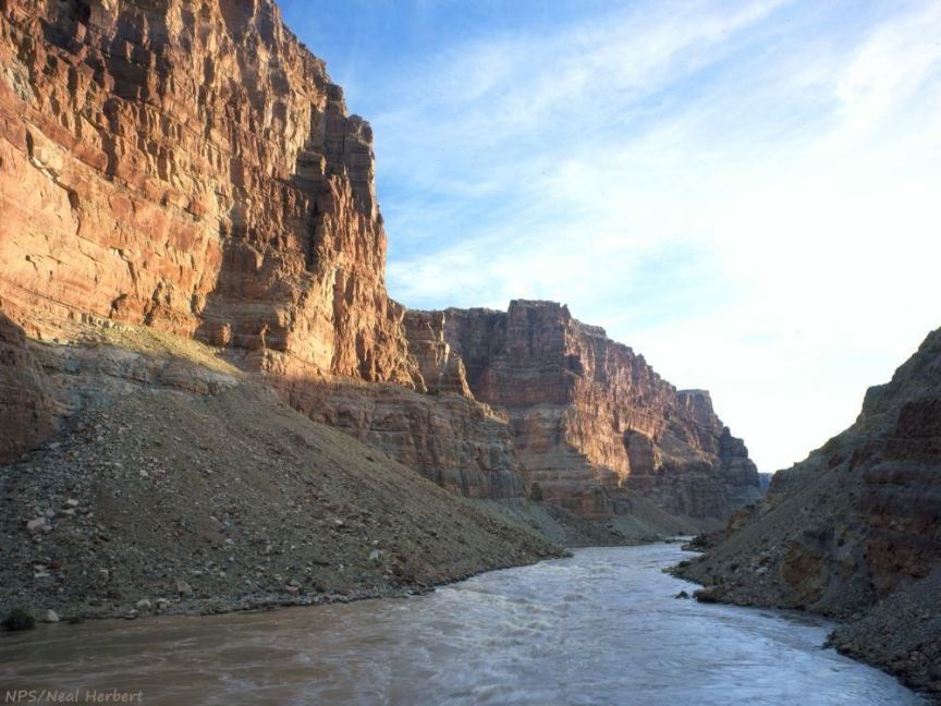
Glen Canyon below the dam - Glen Canyon continues 15 miles from Glen Canyon Dam to Lee's Ferry & Marble Canyon
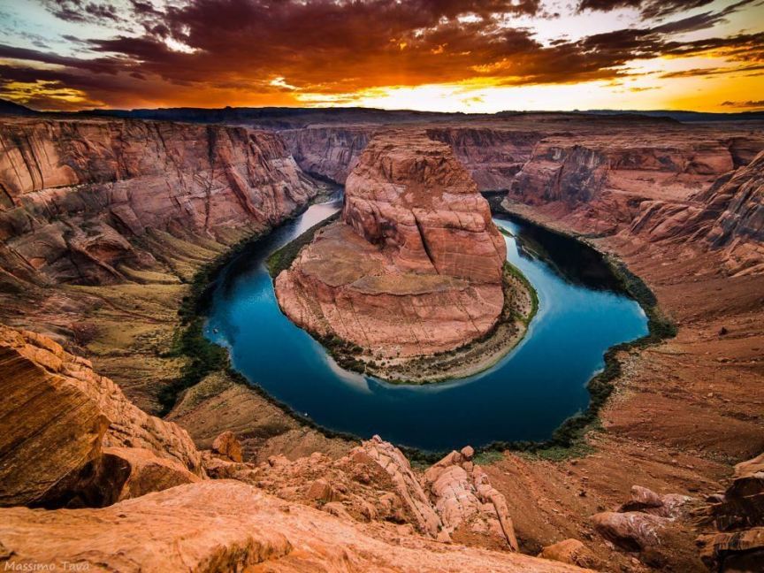
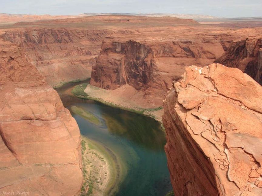
Horseshoe Bend in lower Glen Canyon, about half-way between the Glen Canyon Dam and Lee's Ferry
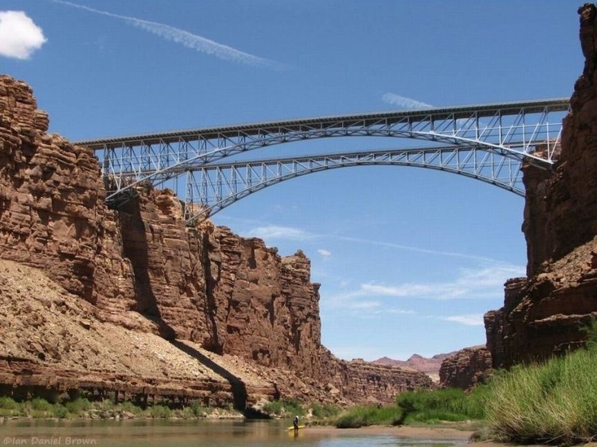
Looking upstream in Marble Canyon through Navajo Bridge with Echo Peaks on the horizon
Marble Canyon from historic Navajo Bridge, now a pedestrian walkway (Echo Peaks visible)
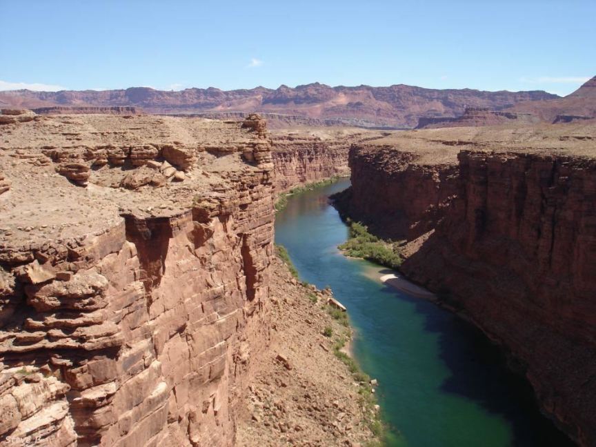
Canyon at Mid-day
in Marble Canyon, looking downstream on the Colorado
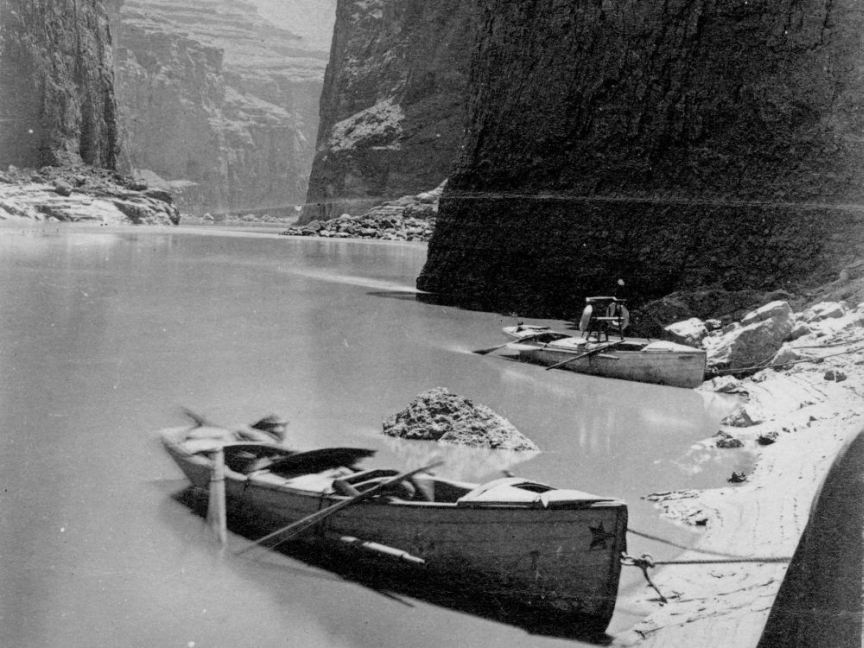
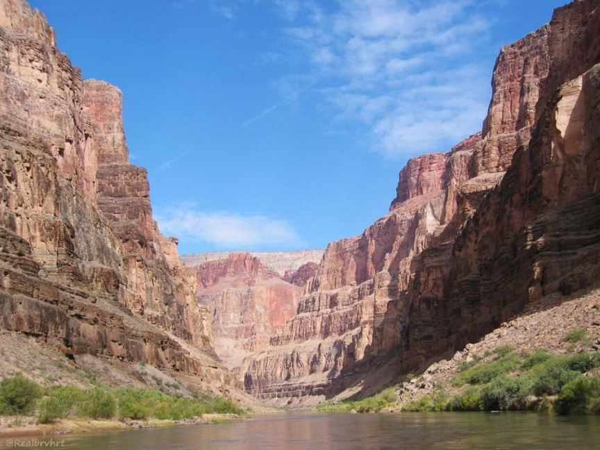
Noon Day Rest in Marble Canyon,
1872, from John Wesley Powell's 2nd expedition (a link in the gallery has more info)
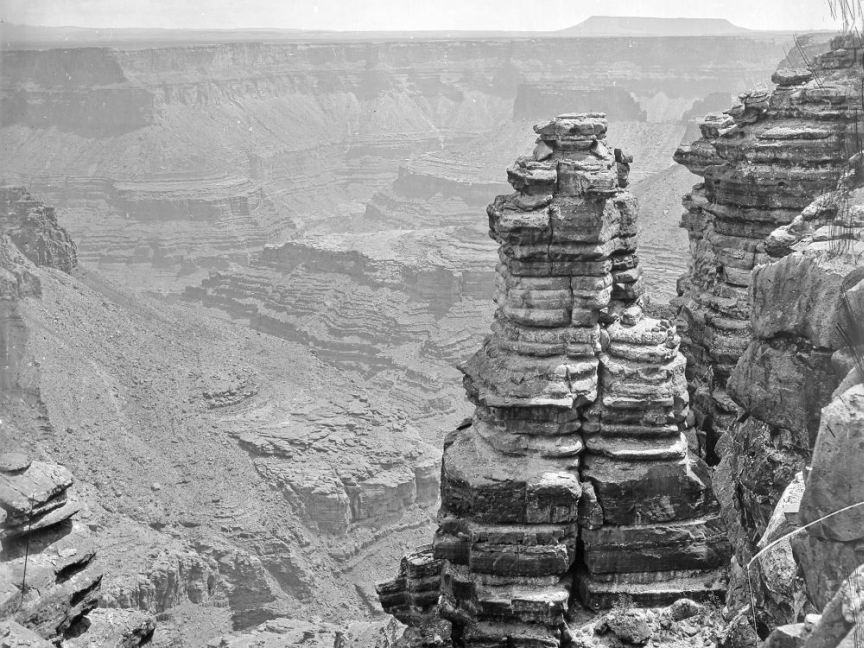
Looking into Marble Canyon, Shinimo Alter in the distance, December 31,1870 (a link in the gallery has more info)
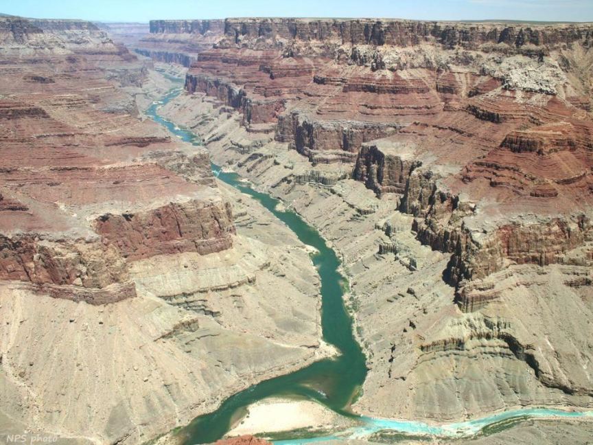
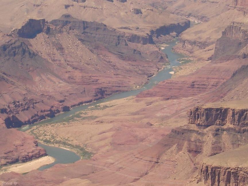
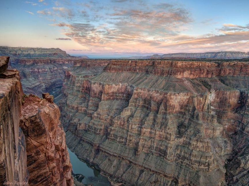
Confluence of the Colorado and Little Colorado, the west end of Marble Canyon
The Grand Canyon side of its junction with Marble Canyon, a view into the canyon from a south rim viewpoint
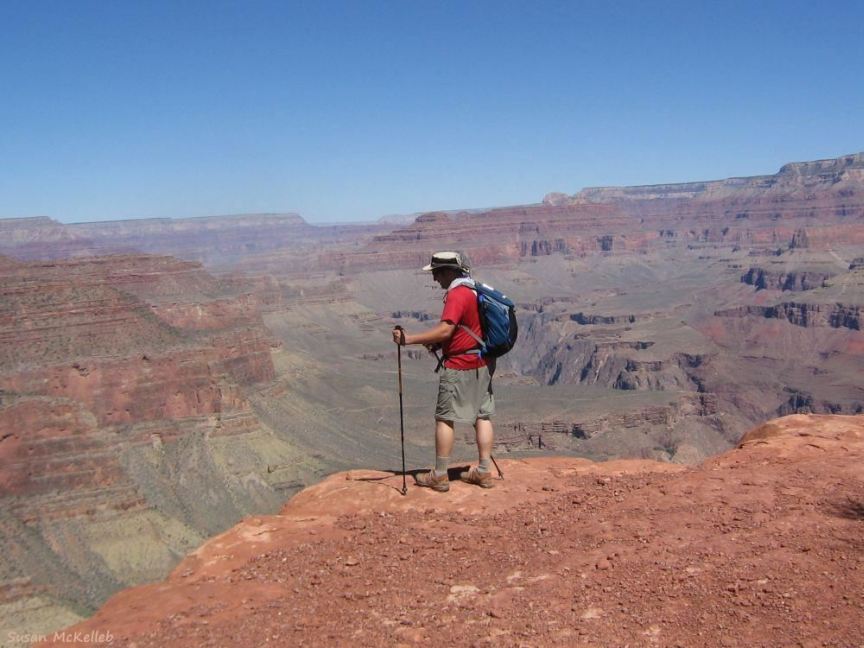
Dave On the Edge,
looking down into the canyon
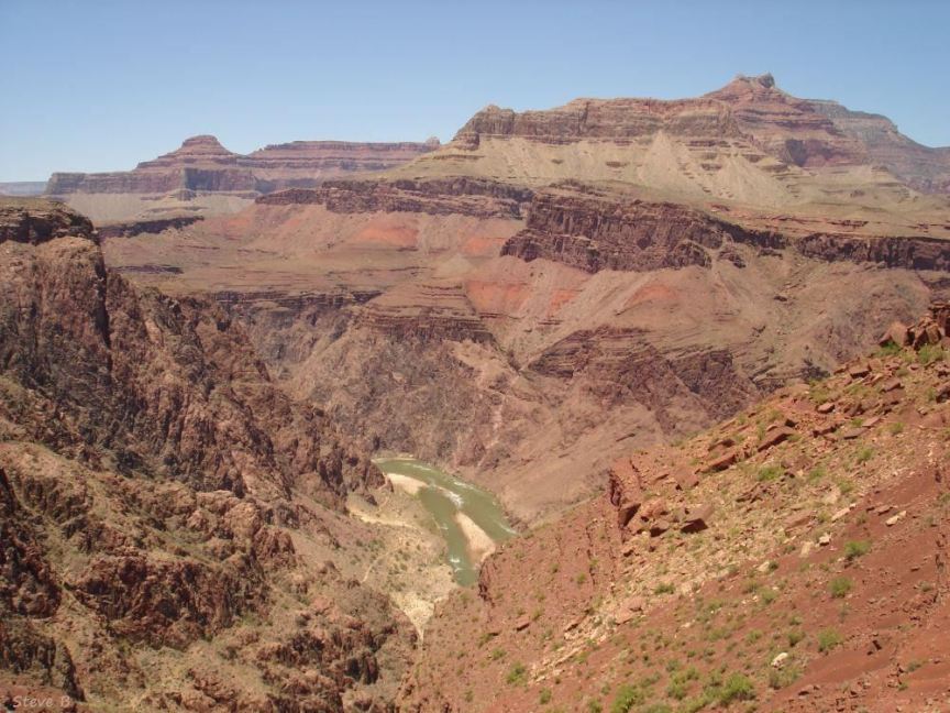
View from the South Kaibab Trail into Grand Canyon and Colorado River on the canyon floor
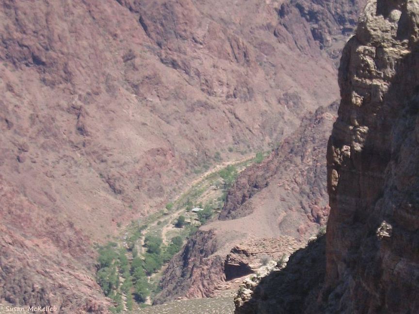
Phantom Ranch and campground in Bright Angel Canyon, from the River Trail overlook in Grand Canyon
Toroweep Sunrise
from Toroweep overlook near the place where Grand Canyon NP and Lake Mead NRA merge
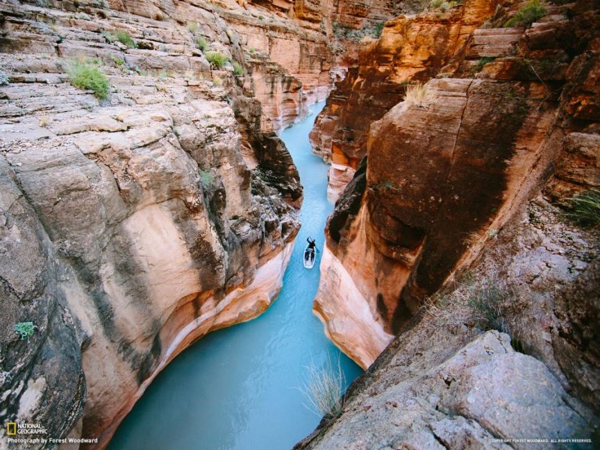
Stand-Up Paddleboarding Havasu Creek
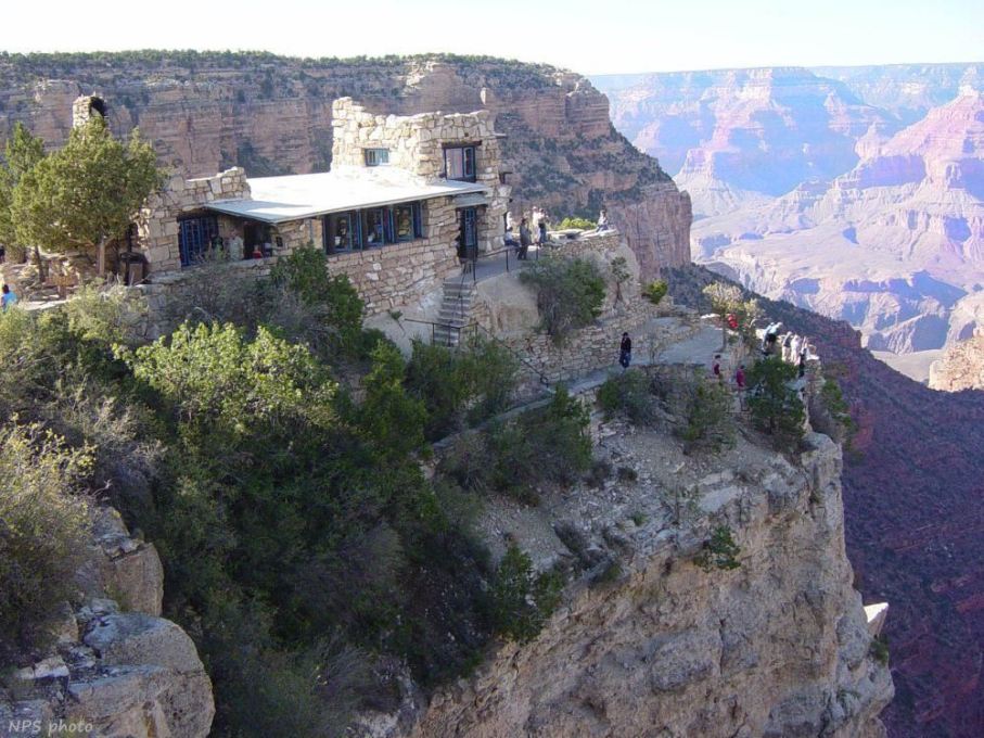
Lookout Studio in Grand Canyon Village on the south rim
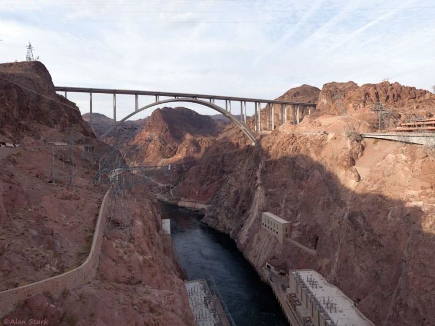
Black Canyon and Hoover Dam Bypass viewed from Hoover Dam
Abandoned catwalk, used in the 1930s to get to the Water Guaging Station
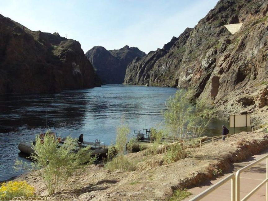
Raft launch in Black Canyon, below Hoover Dam
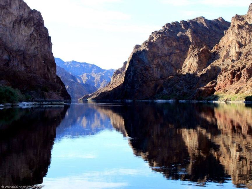
Colorado River in Black Canyon below Hoover Dam
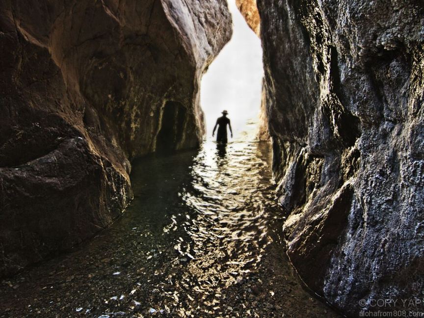
White Rock Canyon, a tributary to Black Canyon downstream from Hoover Dam
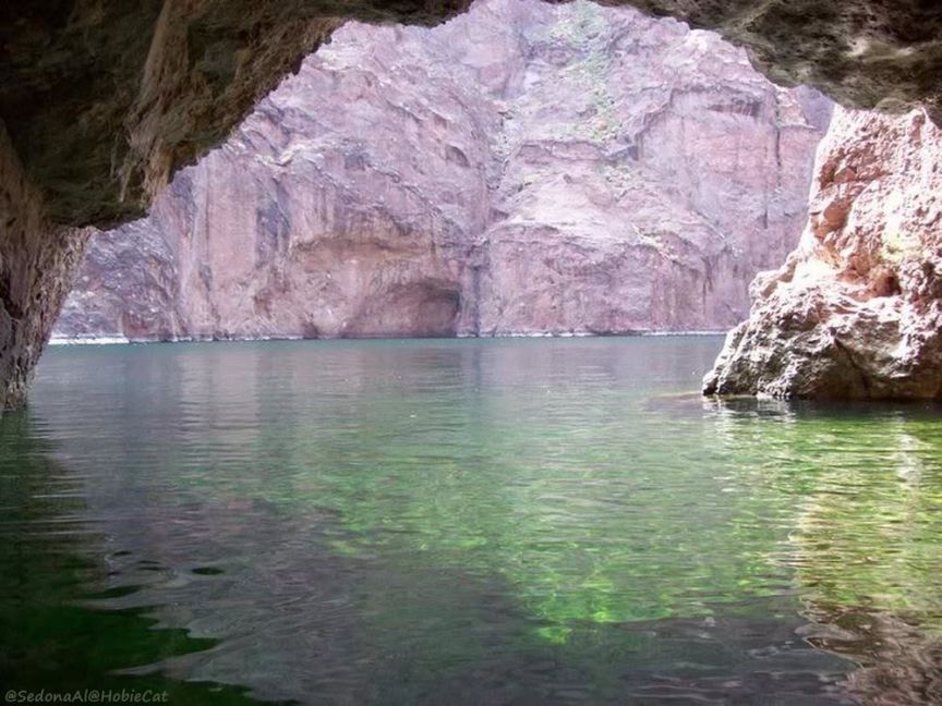
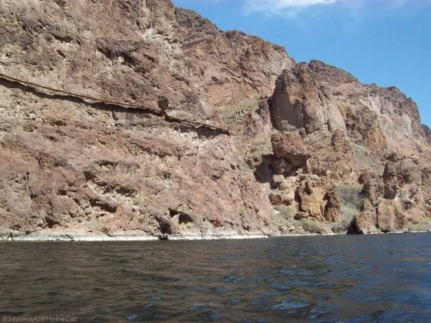
Emereld Cove in Black Canyon, near Willow Beach