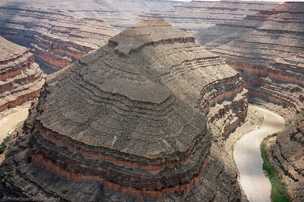
Mendenhall's cabin on the point inside the 1st loop, the tabernacle
inside the 2nd loop
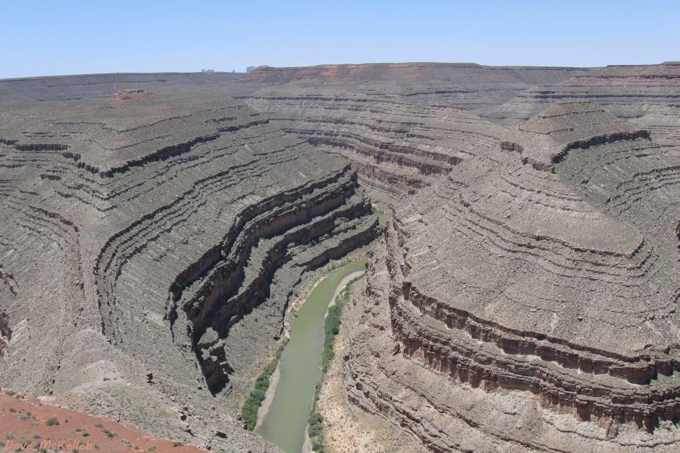
Looking across the incised meandors with an outstanding view of the geology
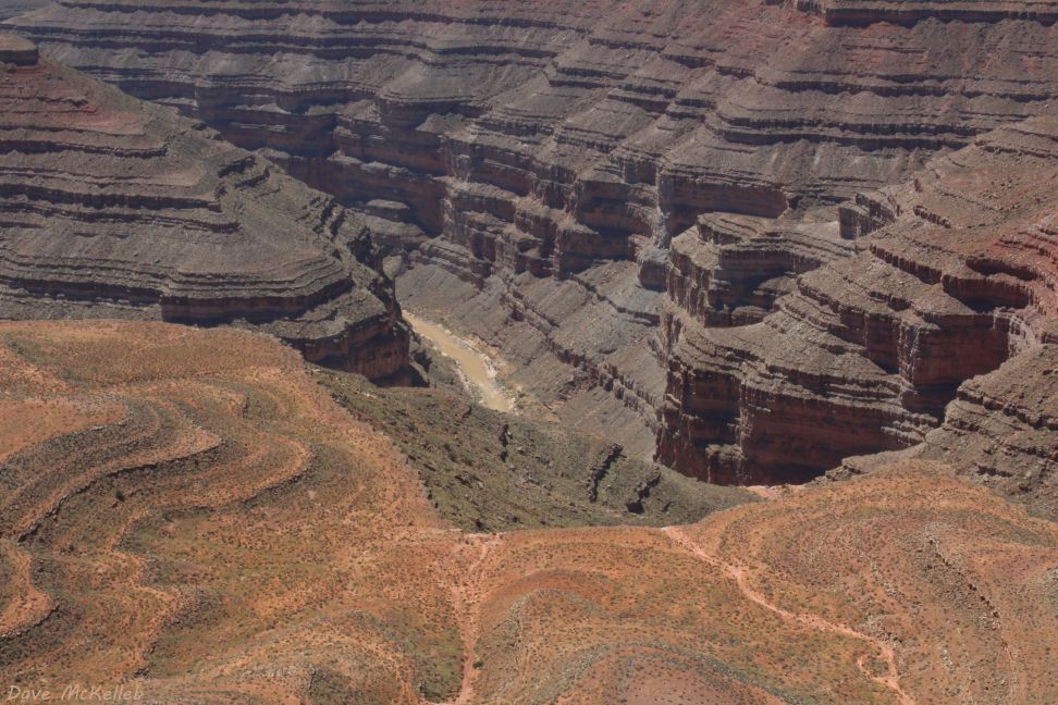
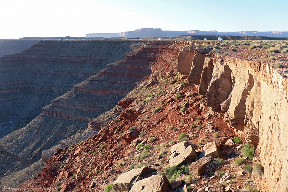
Looking into the canyon from the state park viewpoint
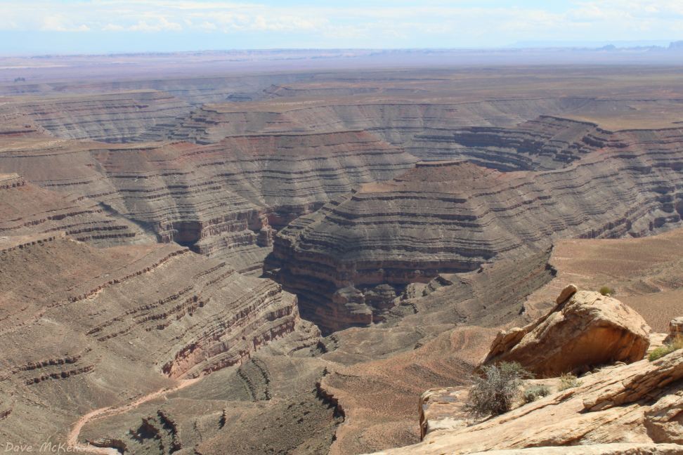
View into the canyon from Muley Point
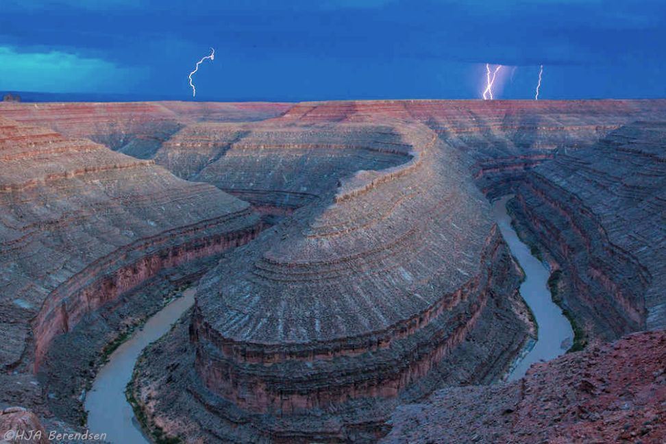
Lightning storm over Goosenecks State Park
Camping on the rim at Goosenecks State Park
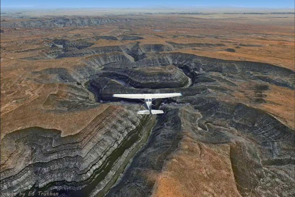
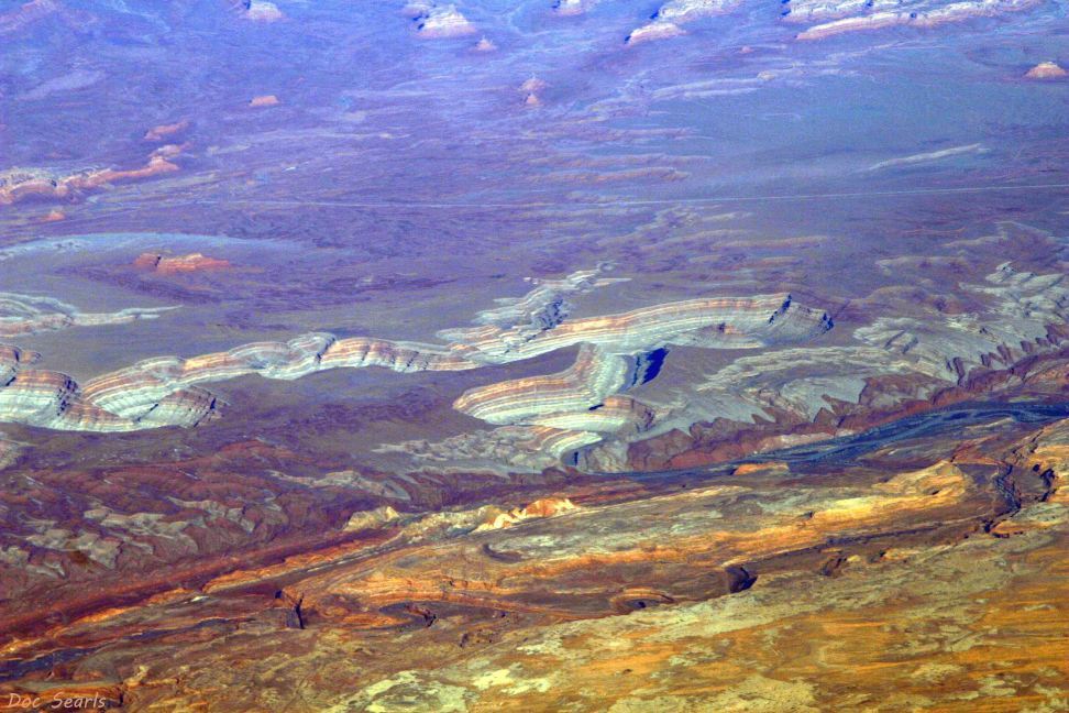
Aerial view to the southeast, Utah 316 ending at the park view point on the left
Goosenecks of the San Juan west of the park, view from Muley Point
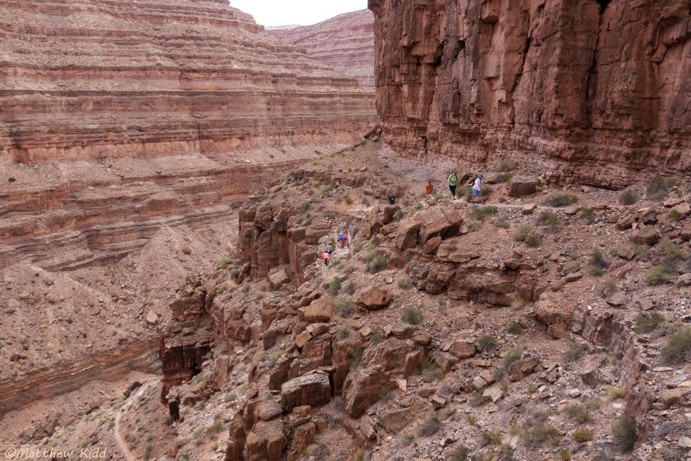
Honaker Trail in the canyon on the goosenecks of the San Juan
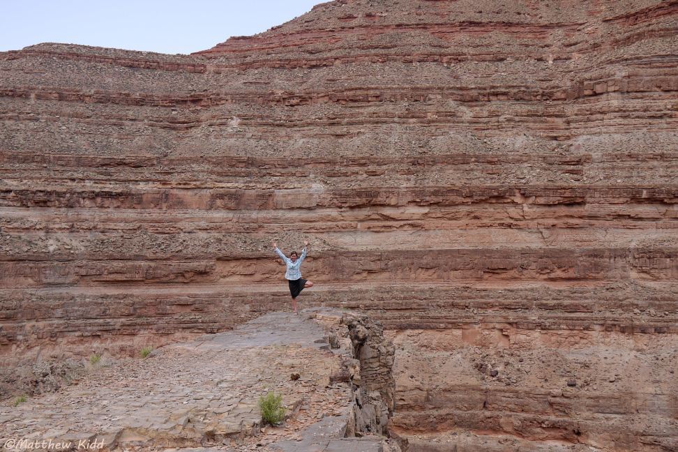
Rafting guide strikes a pose at Horn Point, halfway up the Honaker Trail
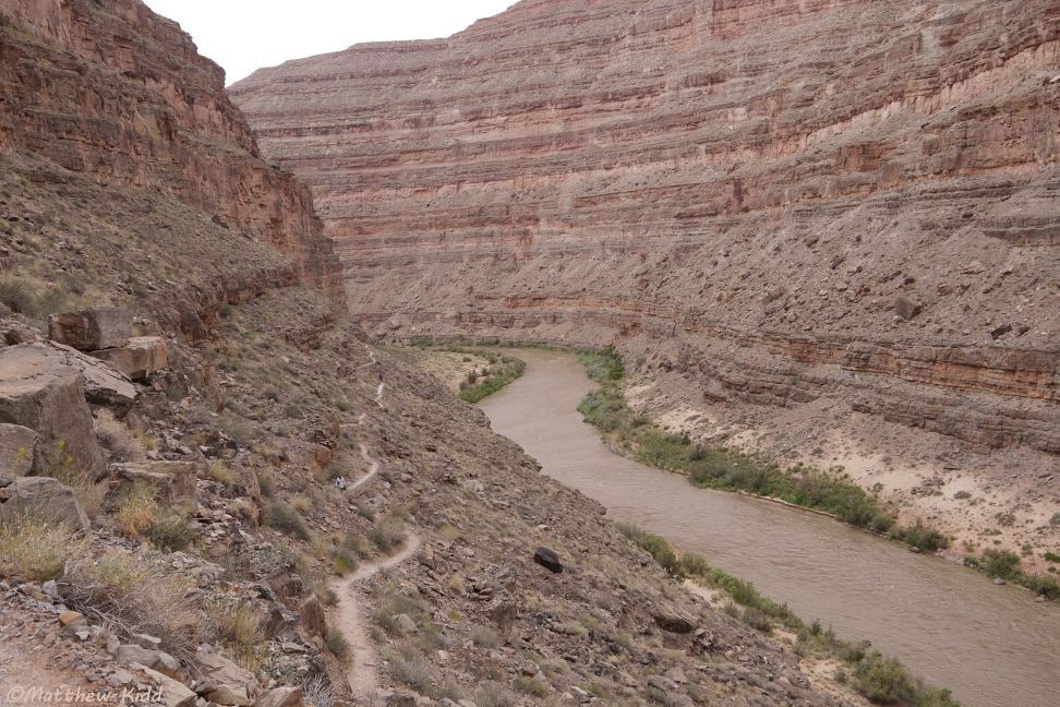
View of the Honaker Trail on the canyon wall alongside the San Juan
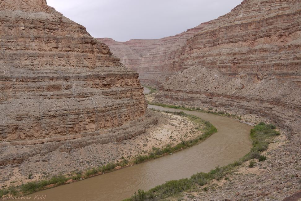
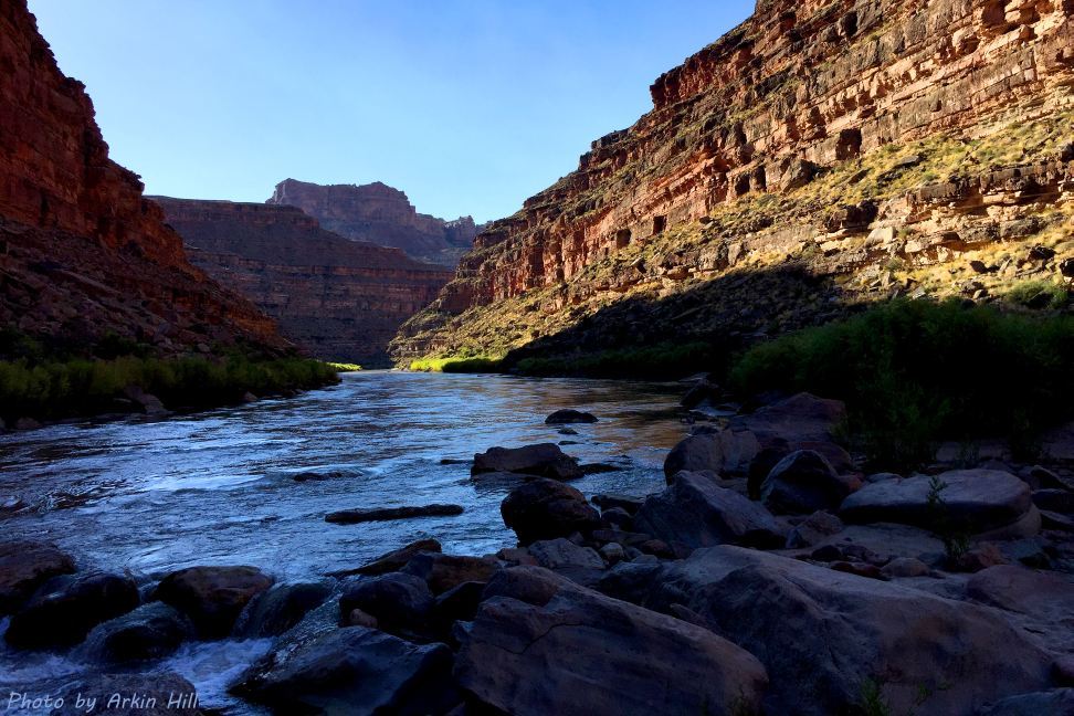
View of a muddy San Juan in the goosenecks canyon
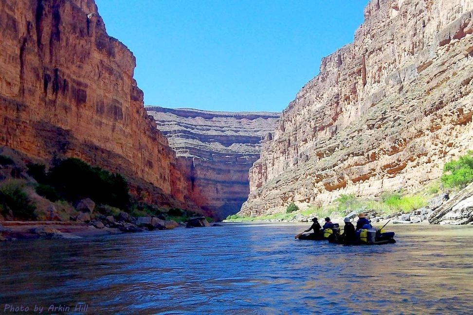
Rafters on the San Juan in the goosenecks
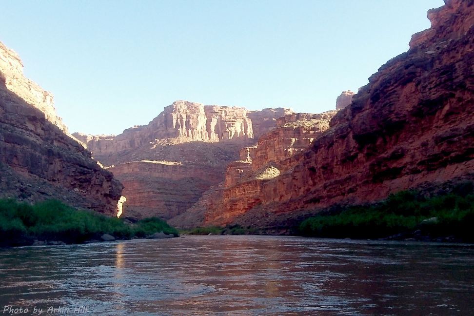
View in the gooseneccks from the surface of the San Juan
Government Rapids of the San Juan, below (west of) Goosenecks State Park
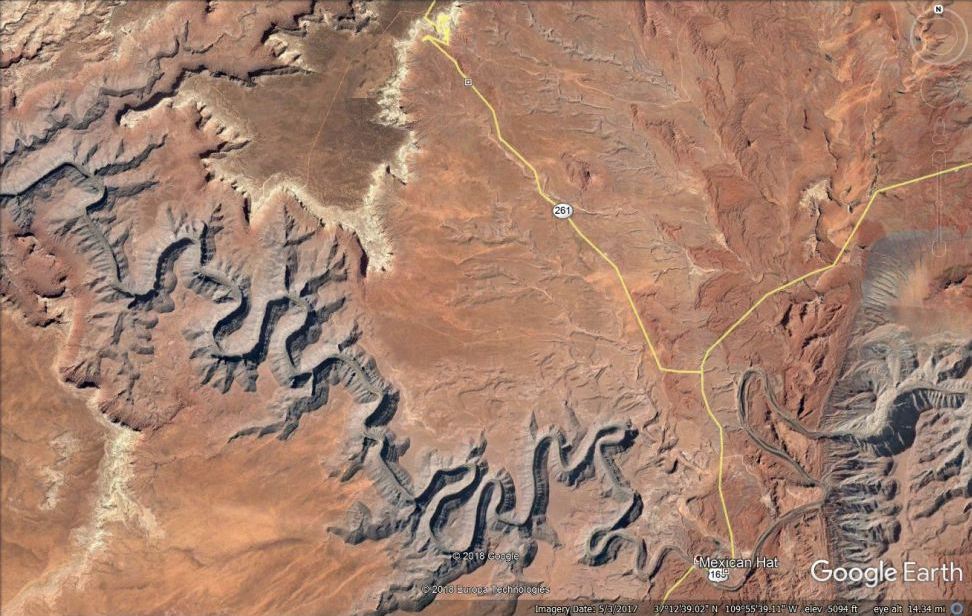
Interesting Google Earth view of the area with Goosenecks State Park on the lower right, difficult-to-get-to incised meanders to the west outside the park on the left, Moki Dugway switchbacks on Utah 261 at the top, and Muley Point road off Moki Dugway with outstanding views to the south across goosenecks of the San Juan to Monument Valley and Raplee Ridge