Scenic Byway 128 - Utah State Highway 128
the Colorado Riverway, the Upper Colorado River Scenic Byway
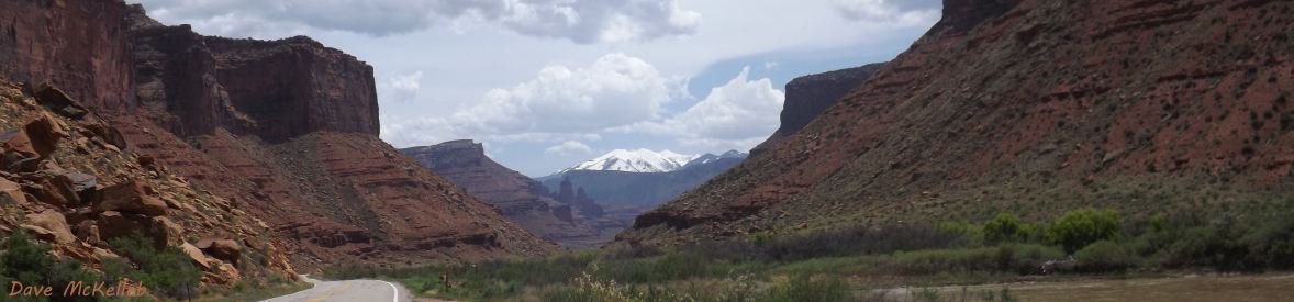
Scenic Byway 128 (SB128) is 67 or 71 miles (explanation below) of canyons, geology, and scenery going northeast up a gorge of the Colorado River, from US191 two miles north of Moab, Utah, to I-70 in the middle of nowhere between Green River, Utah, and Grand Junction, Colorado.
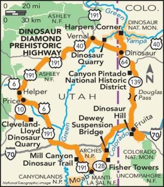
The road has additional names: the Colorado Riverway (below Dewey), the Upper Colorado Scenic Byway, [part of] the Dinosaur Diamond Prehistoric Highway, and known simply as "the river road" by locals.
The Lower Colorado River Scenic Byway continues along Utah 279 on the north side of the river, west of Moab.
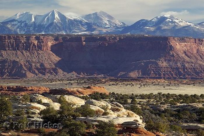
The BLM, describing the Colorado Riverway: The only stretch of the Colorado River in Utah accessible by paved highways, the riverway allows visitors to drive along the river, enjoying the scenic wonderland of colorful cliffs, river-carved canyons, and massive sandstone spires.
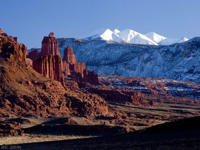
From US191, SB128 goes through a gorge (an unnamed canyon) on the south side of the Colorado (Arches National Park lies just across the river), through Professor Valley, through another unnamed canyon to ghost town Dewey at mile 48, where it crosses the Colorado, turns north at mile 54, leaving the river.
From this point the scenic views are the La Sal Mountains to the south, the Book Cliffs to the north, and the Uncompahgre Uplift to the east.
The junction with old US6/US50 at mile 67, Cisco Junction,
is the historic end of SB128 - the 67-mile route indicated at the top.
The current designation of SB128 turns west for 4 miles to I-70 exit 202 - 42 miles east of Green River, Utah, and 59 miles west of Grand Junction, Colorado - the 71-mile route.
Turning east on US6/US50 at Cisco Junction, the highway reaches ghost town Cisco at mile 71, and I-70 exit 212 at mile 80.
Exit 212 is also a route to the Cisco take-out at the end of Westwater Canyon (more information on these canyons can be found at Colorado River Canyons).
West off US191 on the north side of the Colorado is the Lower Colorado Scenic Byway, Utah State Highway 279, also known by locals and on some maps as Potash Road. The pavement ends after 15 miles, where it becomes Potash Road until it meets Shafer Trail at an unnamed canyon beside Dead Horse Point (still known locally and on some maps as Potash Road), passes under Dead Horse Point, meets the White Rim Trail, and climbs switchbacks where it ends in Canyonlands just north of the visitors center. More precise info on this and other area backroads is at White Rim Trail.
Historically isolated from Utah population centers, the Moab area depended on the Heavenly Stairway,
a trail reaching 10,000 feet (3,045 m), to get food and supplies from Grand Junction.
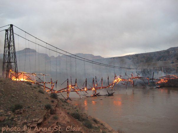
In 1902, Samuel King built a toll road along the river to replace the difficult trail, and operated a ferry at the current location of Dewey bridge.
In 1913, floating ice sunk the ferry, putting it out of business.
Grand County, Utah, funded the building of Dewey bridge in 1913.
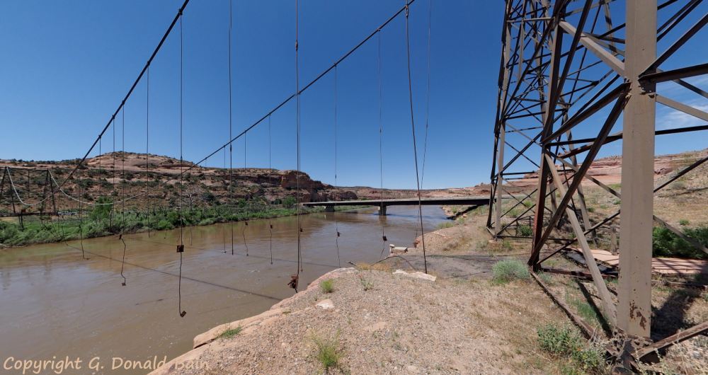
Completed in 1916, it was the longest suspension bridge in Utah until it was destroyed by fire in 2008.
The skeleton remains.
The Campground Map locates BLM campgrounds along the Colorado River Byway section of SB128 (the western 48 miles).